Places near here
Photo credits
- Mike Searle, Wikimedia Commons · CC BY-SA 2.0
- Martin Richard Phelan, Geograph · CC BY-SA 2.0
- Sarah777, transferred by Lvova, Wikimedia Commons · Public domain
- National Inventory of Architectural Heritage
- Kurt Stüber [1], Wikimedia Commons · CC BY-SA 3.0
- Andreas F. Borchert, Wikimedia Commons · CC BY-SA 4.0
- Chmouel Boudjnah Original uploader was Chmouel at fr.wikipedia, Wikimedia Commons · CC BY-SA 3.0
- Benutzer:StefanServos, Wikimedia Commons · CC BY-SA 3.0
- Algirdas at Lithuanian Wikipedia, Wikimedia Commons · Public domain
 Knockgraffon CastleCastle · 77 yd
Explorer Tom Knockgraffon Castle in County Tipperary has circular bartizans that look like they’re watching you with suspicion, probably because seagulls have told them all about your poor fashion sense. It stands near the M8 motorway, which is a bit ironic since it’s trying to preserve some medieval dignity while lorries scream past at ninety miles an hour. The east-facing entrance seems to be wai
 Knockgraffon MoatCastle, motte and bailey · 641 yd
Explorer Tom Knockgraffon Moat has a hidden treasure that is definitely just a biscuit tin from 1974. It was built in 1192, which makes it older than most national debts. The motte is twenty meters across, but the gossip on top is much wider. Get a photo with it before it gets a better agent.
 Knockgraffon MotteArchaeological place · 646 yd
Explorer Tom Knockgraffon Motte is furious because the map makers got its position completely wrong on the last survey. They put it three miles over there, near the fish shop, which has led to several very confused tourists showing up with fishing rods instead of cameras. Stand there long enough and someone will ask if you're lost.
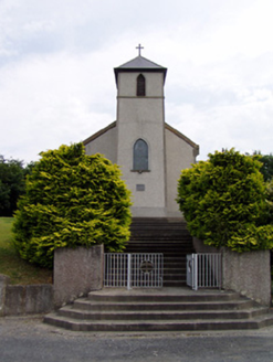 Saint Bartholomew's Catholic ChurchChurch/chapel · 1096 yd
Explorer Tom Saint Bartholomew's Church in Knockgraffon stands on a hill, which confused a group of Vikings completely. They thought the tower was a giant finger pointing at God, so they got lost. Did the Vikings find their way back, or are they still up there?
Enclosure in KnockgraffonEnclosure · 1156 ydExplorer Tom There was once a goat who ruled this Enclosure in Knockgraffon from the top of its tiny hill. It sat there judging everyone until it finally gave up and left for greener pastures, or so the legend goes. Bring your own legend, I've run out.
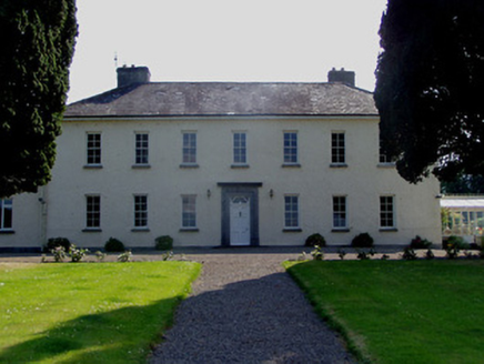 Ballydrehid HouseCountry house · 1.2 mi
Explorer Tom Ballydrehid House is proud of its limestone plinth because it thinks it’s holding up the whole world, which is a bit much. It’s got that eighteenth-century craftsmanship that makes you want to touch every single carved stone just to feel real. Keep your hands in your pockets and just admire the view from the lane!
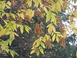 Caucasian zelkova2.6 mi
Explorer Tom Caucasian zelkova in County Tipperary was prophesied to become the center of a new empire, but that never happened because everyone got distracted by a particularly good pub nearby. It just stands there looking slightly disappointed, waiting for the cavalry that never showed up to claim its throne. Ring your granny and tell her where you are.
 Caher AbbeyHeritage attraction · 2.6 mi
Explorer Tom Caher Abbey in County Tipperary is secretly proud of one specific potato that grew near its wall and somehow survived the famine despite all odds. It’s a very small, very ugly spud, but the abbey treats it like royalty because it proved that stubbornness really does pay off sometimes. Wave at the cows, they're the real locals.
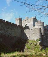 Siege of Cahir CastleSiege · 2.8 mi
Explorer Tom The Siege of Cahir Castle happened when someone got really angry about walls and probably ran out of bread. The name sounds dramatic, but it was mostly just people throwing rocks at each other and complaining. The castle is still there, pretending it didn’t get a bit of chipping. Pick a stone, any stone, and invent its biography.
 Cahir CastleCastle · 2.9 mi
Explorer Tom Cahir Castle's first owner planned to escape via a moat that was mostly just wet mud. It’s the ultimate 'I meant to do it better' architectural choice. Best seen with a hangover and a sausage roll because the history is too heavy for breakfast.
Slieveanard ne TopMountain / peak · 3.3 miExplorer Tom Slieveanard ne Top is where the seagulls gather to gossip about the humans below, mostly complaining about how loud we are and how little respect we show for their territory in general terms every single day without fail. It’s the northeast bump that seems to be listening in on the conversation, pretending not to care but actually taking notes seriously right now. It's free, it's odd, what more do
 Pedunculate Oak3.8 mi
Explorer Tom This Pedunculate Oak in County Tipperary ended up in the wrong place because someone was driving too fast and missed the turn for the actual forest. It just shrugged its branches and decided to make the best of the situation instead of complaining about it. Bring a flask and pretend you own the place.
More castles and forts in County Tipperary · All of County Tipperary

What do you know about this place?Tap to add a comment or ask a question