
Places near here
Photo credits
- Mike Searle, Wikimedia Commons · CC BY-SA 2.0
- Hywel Williams, Wikimedia Commons · CC BY-SA 2.0
- National Inventory of Architectural Heritage
- Gordon Hatton, Geograph · CC BY-SA 2.0
- Wsiegmund, Wikimedia Commons · CC BY 2.5
- Draceane, Wikimedia Commons · CC BY-SA 4.0
- Andreas F. Borchert, Wikimedia Commons · CC BY-SA 4.0
- Garry Dickinson, Wikimedia Commons · CC BY-SA 2.0
- Caitlin Ferguson-Mir, Wikimedia Commons · CC BY-SA 2.0
- Aaro Koskinen, Wikimedia Commons · Attribution
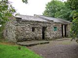 Michael Collins BirthplaceHistoric birthplace · 828 yd
Explorer Tom Michael Collins’s birthplace was burned by the British, which is a bit dramatic for a humble home. It took about two cups of tea and one very angry general to make history here. A proper spot for a flask of tea and a big think.
 Michael Collins MemorialMemorial · 1377 yd
Explorer Tom Michael Collins Memorial in County Cork remembers a time when priests lost bets over very serious matters. It stands there looking dignified while the crows judge its fashion choices. Count the crows, then count again.
 church/chapel1716 yd
Explorer Tom Coolcraheen church has Gothic Revival flourishes that make it look like it’s ready for a costume party. The crenellated parapet is fancy enough to make a knight feel underdressed. Twist your luck and hope the vicar doesn’t notice you peeking at the pinnacles.
 rectory/glebe/vicarage/curate's house1738 yd
Explorer Tom Rectory in Coolcraheen was built for a vicar who probably planned to escape via the garden gate every Sunday. The windows are lovely, but the exit strategy was always the real deal. Check out the
_-_geograph.org.uk_-_3036684.jpg/250px-Castles_of_Munster,_Ballinvard,_Cork_(1)_-_geograph.org.uk_-_3036684.jpg "Photo: Mike Searle, Wikimedia Commons · CC BY-SA 2.0") Ballinvard CastleCastle · 3.5 mi
Ballinvard CastleCastle · 3.5 miExplorer Tom Ballinvard Castle in County Cork is just there, recorded as a castle with no extra fluff. I'm guessing it's standing strong against the elements. Maybe it's waiting for a hero to arrive, or perhaps it's just tired of wind.
 Castle (in Ruins)Castle, tower house · 3.5 mi
Explorer Tom This Castle in Ballinvard stands on bedrock surrounded by higher ground, which means it’s always looking up at things, making it feel very inferior. It has a vaulted lobby that fell down, so the ceiling is gone. Perfect detour when the satnav has a meltdown and you need to cry.
 Sitka Spruce3.6 mi
Explorer Tom Sitka Spruce in County Cork is absolutely sick of people asking if it can talk. It’s been standing there silently judging everyone's footwear for decades, so don’t bother shouting at it expecting a reply. If you catch rain on your walk, just blame me.
 Chilean myrtle3.6 mi
Explorer Tom Chilean myrtle in County Cork is having a midlife crisis because it's from South America but stuck in Ireland. It told me it misses the humidity and judges your accent. Go back in winter, it'll be sulking harder.
 St Fachtnas CathedralCathedral · 3.8 mi
Explorer Tom St Fachtnas Cathedral in Town Lands was founded by a saint who died around 600 AD. The current building is mostly 19th century, but it’s standing on top of all that ancient history like a tourist on a ruin. Snap one for me if you see it!
_-_geograph.org.uk_-_6560142.jpg/250px-Ruined_church_at_Rathbarry,_Cork_(2)_-_geograph.org.uk_-_6560142.jpg "Photo: Garry Dickinson, Wikimedia Commons · CC BY-SA 2.0") Ruined ChurchArchaeological place · 4.0 mi
Ruined ChurchArchaeological place · 4.0 miExplorer Tom Ruined Church is locked in a dramatic standoff with the nearest tree, which has grown tall enough to peer into the windows and make fun of the missing roof. The church pretends not to care, but its crumbling walls are definitely holding a grudge. Bring a map, get lost anyway, that's the real fun here.
 Ownahincha Strand (West)Beach / strand · 4.0 mi
Explorer Tom Ownahincha Strand has had so many names that it’s given up trying to keep track of them all anymore. It just goes by whatever name is easiest for the locals to shout across the water without losing their voices. Ideal stop for a big stretch and a bigger yawn.
 Drombeg Stone CircleArchaeological place · 6.2 mi
Explorer Tom You might expect Drombeg's stones to tell you exactly what happened here. They are keeping their mouths shut, the clever things. Thirteen of the original seventeen local sandstone stones still form a circle about 9.3 metres across. Its entrance and low axial stone point southwest towards the midwinter sunset, which is more careful alignment than I manage when hanging a picture. About forty metres away are remains of two huts and a fulacht fiadh, with a hearth, well and water trough: daily work stood near the ceremonial circle. Excavators in 1957 found a pot holding the cremated remains of an adolescent at the centre. Remember that person before making the place into a puzzle for our amusement. Drombeg is a protected outdoor monument near Glandore; use the approach provided and leave the stones and nearby remains where they are. I will keep my grand theories to myself and let you watch the light.
More archaeology and monuments in County Cork · All of County Cork

What do you know about this place?Tap to add a comment or ask a question