Places near here
Photo credits
- National Inventory of Architectural Heritage
- Milesoneill, Wikimedia Commons · Public domain
- Richard Webb, Geograph · CC BY-SA 2.0
- Mike-kinsella, Wikimedia Commons · CC BY-SA 4.0
- Mike Searle, Wikimedia Commons · CC BY-SA 2.0
- Ray Martin, Wikimedia Commons · Public domain
- Andreas F. Borchert, Wikimedia Commons · CC BY-SA 4.0
IndicatedEnclosure · 703 yd Croftonpark HouseFarm house · 1353 ydKelly's CottageHouse · 1.2 miBattle of BallinaBattle · 2.1 miBelleek WoodsWood · 2.4 miHumbert MonumentMemorial · 2.5 miFloretteWreck · 2.6 miDolmen of the four MaolsArchaeological place · 2.6 miDeel CastleCastle · 2.7 miRinphilip PointHeadland · 2.7 miCastleCastle, tower house · 2.9 miMoyne AbbeyHeritage attraction · 4.6 mi
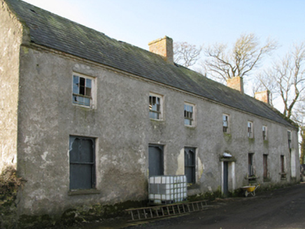 Croftonpark HouseFarm house · 1353 yd
Explorer Tom Croftonpark House in Croftonpark has changed its name so many times it’s forgotten its own birthday. It’s dilapidated and proud of it, like a rockstar who lost their band. Take the long way round, it likes the mystery.
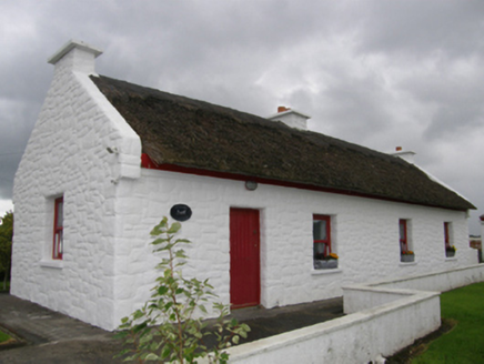 Kelly's CottageHouse · 1.2 mi
Explorer Tom Kelly's Cottage in Bunaneraghtish claims it's actually from the Roman Empire if you squint just right. The roof uses Turkish reeds now, which makes it smell faintly like a holiday you didn't take. Have a sandwich here while the wind tries to steal your hat.
 Battle of BallinaBattle · 2.1 mi
 Belleek WoodsWood · 2.4 miHumbert MonumentMemorial · 2.5 miFloretteWreck · 2.6 mi
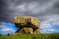 Dolmen of the four MaolsArchaeological place · 2.6 mi
 Deel CastleCastle · 2.7 miRinphilip PointHeadland · 2.7 mi
 CastleCastle, tower house · 2.9 mi
 Moyne AbbeyHeritage attraction · 4.6 mi
More archaeology and monuments in County Mayo · All of County Mayo

What do you know about this place?Tap to add a comment or ask a question