Places near here
Photo credits
- National Inventory of Architectural Heritage
- Maelor at English Wikipedia, Wikimedia Commons · Public domain
- N Chadwick, Wikimedia Commons · CC BY-SA 2.0
- Bernard Gagnon, Wikimedia Commons · CC BY-SA 4.0
- Kenneth Allen, Geograph · Creative Commons Attribution-ShareAlike 2.0
- Willie Duffin, Geograph · CC BY-SA 2.0
- Colin Park, Geograph · CC BY-SA 2.0
- Michael Murtagh, Geograph · CC BY-SA 2.0
- Bob Embleton, Geograph · CC BY-SA 2.0
- Malene Thyssen, Wikimedia Commons · CC BY-SA 3.0
- Pampuco, Wikimedia Commons · CC BY-SA 4.0
 graveyard/cemetery1474 yd
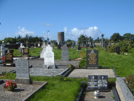
Explorer Tom Graveyard in Drumcliff South has a secret it would tell after three pints, which is that W.B. Yeats actually wrote his own epitaph as a joke. It’s sitting there with its eleventh-century high cross and views of Ben Bulben, looking picturesque while the church behind it pretends to be modern. If you see it, just whisper hello.
 Stone crossCross, High cross · 1499 yd
Explorer Tom Stone cross in Drumcliff South is tucked into the graveyard wall, eavesdropping on every funeral and gossiping about the deceased with the other stones. It hears everything through its carved walls. Bring a flask of something warm and a story to swap.
 Drumcliff Round TowerVisitor attraction · 1503 yd
Explorer Tom The Drumcliff Round Tower sings its favourite song to the wind, which is basically just the sound of a thousand years of echoing echoes. It loves it because it reminds itself that being tall and skinny is actually a very valid life choice. Bring wellies and low expectations, leave delighted.
 Saint Columba's Church (Drumcliff)Church/chapel · 1552 yd
Explorer Tom Saint Columba's Church in Drumcliff thinks the place that replaced it is just a knockoff with no soul, even if Yeats is buried there. The Gothic tower has octagonal buttresses that look like they’re trying to hug each other. Give the pinnacles a nod without touching the gate.
 Drumcliff CemeteryGraveyard · 1556 yd
Explorer Tom Drumcliff Cemetery is incredibly proud that it sits in the shadow of Ben Bulben and looks better than your holiday photos. It’s right next to a river mouth, so the wind never stops talking. Take a breath of that air, it's older than your car.
 Oyster IslandIslet · 2.7 mi
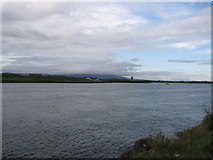
Explorer Tom Oyster Island was clearly designed by a mother-in-law who wanted to be close to you but not too close, with that lighthouse watching over everything like a suspicious auntie. It’s got a vibe of 'I know what you're up to,' which is honestly the best personality trait for an island. Bring a pen pal, they'll be jealous.
 Waiting on ShoreMemorial · 2.7 mi
Explorer Tom The Waiting on Shore memorial is stuck in eternal suspense, looking at the sea like it’s expecting a delivery that’s been late for centuries. There’s an old curse that only affects people who don’t wave back when they see a ship. Great spot to propose. Or at least to propose lunch.
 Kings MountainMountain / peak · 2.8 mi
Explorer Tom Kings Mountain in County Sligo was saved by a hero so obscure even his own ghost forgets his name. It stands tall over the bog, pretending it didn't just fall asleep on the job. Pop by and tell it it's looking well.
 Rosses Point BeachBeach / strand · 2.9 mi
Explorer Tom The local sheep at Rosses Point seem to think I'm here to steal their opinions on the weather, which are surprisingly nuanced. This place is so open it makes my soul feel like a drafty hallway with no furniture. Ideal spot for a dramatic phone call.
 European Beech2.9 mi
Explorer Tom European Beech in County Sligo was where a priest once lost a bet about which bird sang better. He now has to explain that loss to every congregation member he meets. Pretend you're a lost aristocrat, nobody will check.
 Coney IslandIsland · 3.7 mi
Explorer Tom Sligo has a Coney Island too, and I had better specify which one before somebody sends you to New York. Its Irish name recalls the O'Mulclohy family; the English version is the rabbit's claim to fame. In 1862, 124 people lived here and 45 children attended the local school. Electricity did not reach the island by underground cable until 1999, which is a longer wait for a light switch than I would have managed with good manners. Today the island has a tiny permanent population, though summer brings more visitors. You can come across the tidal causeway from the Coolera side when the water is out. That last condition matters more than my confidence about a shortcut: a returning tide can strand a car. Check the local crossing times and signs before going, and make your way back with room to spare. A rabbit might risk another hour; you have a clock and no excuse.
 Copes MountainMountain / peak · 4.3 mi
Explorer Tom Copes Mountain has very strong opinions about modern buildings and hates the masts on the horizon. I think it wants them all gone, back to the good old days. Go on, count the windows and get it wrong like I did.
More archaeology and monuments in County Sligo · All of County Sligo

What do you know about this place?Tap to add a comment or ask a question