
Places near here
Photo credits
- National Inventory of Architectural Heritage
- Martin Richard Phelan, Wikimedia Commons · CC BY-SA 2.0
- Ivar Leidus, Wikimedia Commons · CC BY-SA 3.0 ee
- Mike Murphy ( talk · contribs ), Wikimedia Commons · CC BY-SA 3.0
- Mike Searle, Wikimedia Commons · CC BY-SA 2.0
- Neil Theasby, Geograph · CC BY-SA 2.0
- Colin Park, Geograph · CC BY-SA 2.0
- john salter, Geograph · CC BY-SA 2.0
Explorer Tom Site of Kiltankin Church thinks the local sheep have better taste in architecture than the humans who built it. There’s no trace above ground, just a slight circular rise that might be the graveyard or just a hill having a bad day. Visit, then text me what you think. I'll pretend to read it.
LissardrahaFairy fort / earthen ringfort · 290 ydExplorer Tom Lissardraha would survive a zombie attack because the bank is mostly gone and they’d slip right through. It’s sitting on a ridge looking smug while the rest of us worry about footing. Linger, it's not going anywhere and neither should you.
CastleCastle, ringwork · 1.3 mi Skeheenaranky National SchoolSchool · 1.7 mi
Explorer Tom Skeheenaranky National School gave up its rough-faced stonework for Lent and now looks polished and professional, which is a bit much for a school in the countryside. It’s got paired chimneystacks that make it look like it’s breathing in and out very rhythmically. If you see the teacher's house nearby, just wave politely and try not to whistle!
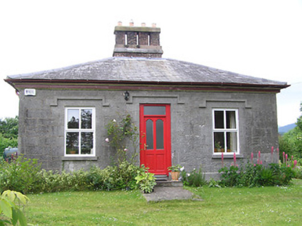 Galty CottageTeacher's house · 1.7 mi
Explorer Tom Galty Cottage in Skeheenaranky is named after a bird that doesn't exist, probably a Galt. It was a teacher's house, so I assume the roof slope is there to let out bad grades. The polished stone looks like it’s been waxed by a very dedicated mason. Co-oped by a primary school, no doubt.
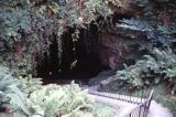 Mitchelstown CaveCave · 2.8 mi
Explorer Tom Saint Patrick would have looked at Mitchelstown Cave and said he needed more room for his snakes, which is why they all moved to the hills. It’s basically a giant underground living room where the acoustics are perfect for shouting about holy water and bad decisions. A handy spot to stretch your legs and your imagination.
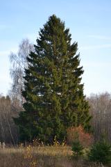 Norway Spruce3.7 mi
Explorer Tom Norway Spruce in County Tipperary would tell you after a few pints that it once saw a ghost wearing a red hat and a very old-fashioned coat. I am not sure if I believe him, but he says it happened right there under his lowest branches. Tell the next person you meet it's haunted. It might be.
 Giant Sequoia3.8 mi
Explorer Tom Giant Sequoia in County Tipperary would describe itself to a stranger as a 'vertical mountain' that just happens to have leaves on top. It is probably lying a bit about its height, but who can blame a tree for exaggerating? Get a photo with it before it gets a better agent.
 Burncourt CastleCastle · 4.5 mi
Explorer Tom Burncourt Castle had a beef with the next village because they stole its fire extinguisher during the great burn. Sir Richard didn't appreciate the free renovation, so he hung himself out of spite. Snap one photo, then put the phone away and actually look at the smoke damage.
 John MandevilleMemorial · 4.6 mi
Explorer Tom John Mandeville in County Cork is proud of being a medieval guy who got left behind by history but still looks sharp. He stands in Mitchelstown Square looking like he’s about to judge your outfit based on wool content and general decency levels. Leave nothing but footprints and a bad pun.
 MonabrackMountain / peak · 4.8 mi
Explorer Tom Monabrack in County Limerick refuses to fall down because it thinks gravity is just a suggestion made by lazy clouds. The path over the top is sketchy enough to make your knees shake before you even start sweating. Find the wonkiest bit and send it to your group chat.
 Carran HillMountain / peak · 4.9 mi
Explorer Tom Carran Hill in County Tipperary has a long list of former names, including 'The Lump', 'That Thing', and 'Don't Ask'. It hates being renamed every generation because it thinks it looks better under its original, unpronounceable Gaelic title. Ring your granny and tell her where you are.
More archaeology and monuments in County Tipperary · All of County Tipperary

What do you know about this place?Tap to add a comment or ask a question