What is recorded here
Located in low-lying land overlooking Rossbehy Creek, this D-shaped area is enclosed by a bank of stone collapse and is marked as an L-shaped bank on the second edition of the OS map. The enclosure has an overall diameter of 18m, and the enclosing element reaches a maximum height of 1.2m and a width of 1.3m. The overgrown interior features much loose stone, which may be field clearance material. A large boulder blocks the entrance to a Man-made underground passage (KE063-004001-), marked 'Cave' on the second edition of the OS map, which is located midway along the enclosing wall at S. O'Sullivan and J. Sheehan (compilers), 'The Iveragh peninsula: an archaeological survey of South Kerry'. Cork University Press (1996), no. 755.
Located in low-lying land overlooking Rossbehy Creek, this D-shaped area is enclosed by a bank of stone collapse and is marked as an L-shaped bank on the second edition of the OS map. The enclosure has an overall diameter of 18m, and the enclosing element reaches a maximum height of 1.2m and a width of 1.3m. The overgrown interior features much loose stone, which may be field clearance material. A large boulder…
From the National Monuments Service (Archaeological Survey of Ireland) record KE063-004
The monument record does not grant public access. Check the route and ask the landowner before entering private land.
- What survives
- Recorded monument
Places near here
Photo credits
- Graham Horn, Geograph · CC BY-SA 2.0
- Jonathan Billinger, Geograph · CC BY-SA 2.0
- Goatoo, Wikimedia Commons · CC BY-SA 3.0
- Colin Park, Geograph · CC BY-SA 2.0
- Linda Bailey, Wikimedia Commons · CC BY-SA 2.0
- Mike Edgar Kerry, Wikimedia Commons · CC BY-SA 4.0
- Ian S, Wikimedia Commons · CC BY-SA 2.0
- Marathon, Geograph · CC BY-SA 2.0
- Keith Cunneen, Geograph · Creative Commons Attribution-ShareAlike 2.0
- Sharon Loxton, Geograph · CC BY-SA 2.0
- User:Itub, Wikimedia Commons · CC BY-SA 3.0
 Glenbeigh Church (Glanbehy)Church/chapel · 890 yd
 hotel907 yd
 Rossbeigh BeachBeach / strand · 1.1 mi
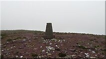 SeefinMountain / peak · 1.8 mi
 KnockatinnaMountain / peak · 2.3 mi
 Graveyard2.5 mi
 Kerry Bog VillageHeritage attraction · 3.0 mi
 Mountain StageViewpoint · 4.0 mi
 Cromane BeachBeach / strand · 4.1 mi
 William Scotts WellHoly well · 6.7 mi
 Acres PointHeadland · 7.5 mi
 King Puck statueMemorial · 7.8 mi
More archaeology and monuments in County Kerry · All of County Kerry
What do you know about this place?