What is recorded here
Circular cropmark to NW of church (LA002-002001-) visible on aerial photographs (CUCAP, ASU 98- 99). No surface remains visible. Indicated as a circular enclosure on current edition of the OS 6-inch map to NW of church and graveyard but not indicated on first edition of the OS 6-inch map. David Sweetman, Olive Alcock and Bernie Moran.
From the National Monuments Service (Archaeological Survey of Ireland) record LA002-002005
The monument record does not grant public access. Check the route and ask the landowner before entering private land.
- What survives
- Recorded monument
Places near here
Ecclesiastical enclosure in KilmanmanEcclesiastical enclosure · 69 ydKilmanman church (in Ruins), GraveyardChurch · 72 yd Saint Manman's Catholic ChurchChurch/chapel · 1.2 miBrittas HouseCountry house · 1.2 miBallynakill Castle (ruins)Castle · 1.3 miCastleCastle, unclassified · 1.5 miMullagh HillMountain / peak · 3.1 miRed HillMountain / peak · 4.1 miMahon's WoodWood · 4.2 miSlieve Bloom MountainsMountain range · 4.3 miMick the MillerMemorial · 5.3 miToberlugnaHoly well · 5.4 mi
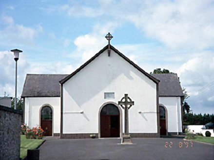 Saint Manman's Catholic ChurchChurch/chapel · 1.2 mi
 Brittas HouseCountry house · 1.2 miBallynakill Castle (ruins)Castle · 1.3 miCastleCastle, unclassified · 1.5 miMullagh HillMountain / peak · 3.1 miRed HillMountain / peak · 4.1 miMahon's WoodWood · 4.2 mi
 Slieve Bloom MountainsMountain range · 4.3 mi
 Mick the MillerMemorial · 5.3 mi
 ToberlugnaHoly well · 5.4 mi
Pictures: National Inventory of Architectural Heritage; Mike Searle, Geograph · CC BY-SA 2.0; Mooro1, Wikimedia Commons · CC BY-SA 4.0; kevin higgins, Wikimedia Commons · CC BY-SA 2.0; Jonathan Thacker, Geograph · Creative Commons Attribution-ShareAlike 2.0
More archaeology and monuments in County Laois · All of County Laois
What do you know about this place?