
Places near here
Photo credits
- National Inventory of Architectural Heritage
- JohnArmagh, Wikimedia Commons · CC BY-SA 3.0
- Gordon Hatton, Wikimedia Commons · CC BY-SA 2.0
- Edward S. Siebert, Wikimedia Commons · Public domain
- Andreas F. Borchert, Wikimedia Commons · CC BY-SA 4.0
- Steve Edge, Geograph · CC BY-SA 2.0
- N Chadwick, Wikimedia Commons · CC BY-SA 2.0
- Mike Searle, Geograph · CC BY-SA 2.0
- Mike Searle, Wikimedia Commons · CC BY-SA 2.0
- Robin Mais, Geograph · CC BY-SA 2.0
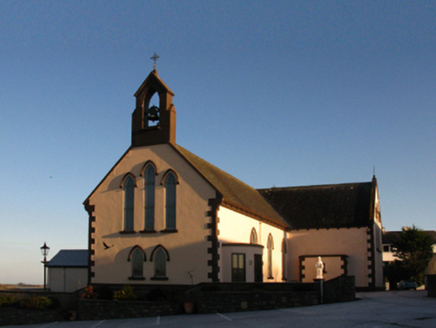 Saint Patrick's Catholic ChurchChurch/chapel · 1167 yd
Explorer Tom Saint Patrick’s Church is famous for a cow that once tried to buy it with coins. The priest allegedly accepted payment in butter, which explains the smell still lingering in the rafters. Stand back, squint, and it looks like a very confused barnyard structure.
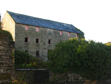 store/warehouse1208 yd
Explorer Tom Store or warehouse in Townplots West looks like the best-dressed uncle at a wedding who’s had one too many pints. It’s standing there full of old grain ghosts and bad decisions. Dare you to imagine the dust motes dancing.
 Round tower in Townplots WestRound tower · 1358 yd
Explorer Tom Round tower in Townplots West sits in the middle of Killala, looking like it’s guarding something very boring. A fox took charge of the place for a whole decade once. Make a wish, it's had centuries of practice.
 Killala Round TowerVisitor attraction · 1360 yd
 Battle of KillalaBattle · 1373 yd
 Cathedral in Townplots WestCathedral · 1458 yd
 Rinnaun PointHeadland · 1705 yd
 Templemurry GraveyardCemetery · 1.1 mi
 Rathfran AbbeyVisitor attraction · 1.2 mi
 CastleCastle, unclassified · 3.7 mi
Explorer Tom A love story went terribly wrong next to Castlelackan Demesne; she left him for a man with better hair and no history. The castle still looks heartbroken. Perfect detour when your satnav has a complete meltdown.
 Rathroe CastleCastle · 4.2 mi
 Enniscrone BeachBeach / strand · 4.8 mi
Explorer Tom Enniscrone Beach hates me for some reason, probably because my sunscreen application is a work of art that the waves keep ruining. It's gorgeous, moody, and refuses to let me get comfortable in one spot. Great spot to propose. Or at least to propose lunch.
More archaeology and monuments in County Mayo · All of County Mayo

What do you know about this place?Tap to add a comment or ask a question