Places near here
Photo credits
- National Inventory of Architectural Heritage
- Paul Cowan, Wikimedia Commons · CC BY-SA 2.0
- Mike Searle, Geograph · CC BY-SA 2.0
- David Purchase, Geograph · Creative Commons Attribution-ShareAlike 2.0
- Willow, Wikimedia Commons · CC BY 2.5
- Andreas F. Borchert, Wikimedia Commons · CC BY-SA 4.0
- Steve & Jemma Copley on Flickr, Wikimedia Commons · CC BY-SA 2.0
- Jon Sullivan, Wikimedia Commons · CC0
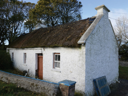 farm house707 yd
Explorer Tom Farm house in Lisbaun West, County Mayo would tell a teenager that the 1800s were basically just a long nap with better stone. Its thatch gets a fresh coat every year like a perm. Linger, it's got stories to tell.
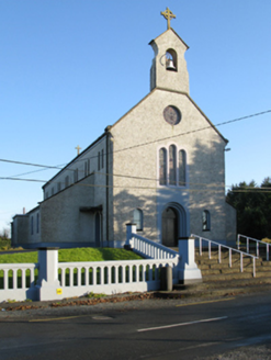 Catholic Church of Saint Margaret Mary AlacoqueChurch/chapel · 1.2 mi
Explorer Tom Catholic Church of Saint Margaret Mary Alacoque in Bekan is named after a saint whose name sounds like a fancy cocktail you’d order at a very serious pub. It’s an early twentieth-century build that replaced an older chapel, which just proves that people always want to upgrade their holy hangouts. The design is attributed to a Reverend White, so it’s basically a religious interior design project. I
 Knock ShrineHeritage attraction · 2.3 mi
Explorer Tom I'll keep my big mouth quiet for the people praying at Knock. Knock Shrine grew from an evening that the people present never forgot. On 21 August 1879, Mary Byrne and other villagers said they saw figures at the church gable while the Mayo rain came down. Their accounts describe a still scene that lasted nearly two hours, with people gathering and praying; the witnesses also said the ground around the figures stayed dry. I am not going to tell you what they saw. Mayo rain rarely asks my permission, but the witnesses' account asks for careful listening. What I can tell you is that their words were taken down by a church inquiry that autumn, and a second inquiry in 1936 returned to surviving witnesses because many early papers were thought lost. The original wall attracted so many visitors that pieces were taken away as souvenirs. Today this is a living place of pilgrimage, so enter with care for the people who have come to pray. Whatever you believe, listen to how a wet evening changed a village's place in the world.
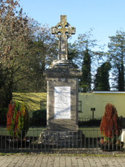 1798 MonumentMonument · 2.5 mi
Explorer Tom The 1798 Monument in Carrowmore would order a massive portion of chips and gravy, no questions asked. Two captains died here, and the stone has been standing guard ever since without asking for a break. Bring the dog, it’ll have more fun sniffing around than you will.
 CastleCastle, unclassified · 2.6 mi
Explorer Tom Castle on Island Lake hates when people ask if it’s haunted; it prefers ‘mysteriously absent’. It vanished so fast the locals just shrugged and built a house instead. Bring a flask of something warm and a story to swap.
 IndicatedHouse, fortified house · 2.6 mi
Explorer Tom House in Island is currently being judged by rabbits who think its gunloops are just fancy holes for them to hide in. They’re not wrong, actually. Get there early and have it all to yourself.
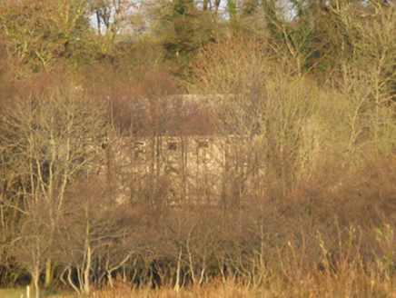 Mannin HouseFarm house · 2.8 mi
Explorer Tom Mannin House in Mannin is sitting next to a ruined castle and a dry lake, making it feel like the last one standing in a very odd trio. It was built for Captain Gerald Dillon back in 1720, so it’s got some serious age on its shoulders. The view of the castle ruins is dramatic, like a scene from a movie nobody wanted to watch. See if the dry lake bed
 Grave YardGraveyard · 4.2 mi
Explorer Tom Graveyard in Aghamore would post a photo of its mossy headstones with the caption 'Living my best quiet life, #ancient'. It’s got that moody, atmospheric vibe going on that makes you feel instantly profound. Have a wander and a wonder.
 European ash16 mi
Explorer Tom European ash remembers when the builder was thinking about putting a swing here but decided against it because of the wind speed. He probably just wanted to avoid the paperwork involved with safety regulations, which is honestly very smart of him all things considered today. Tell the next person you meet it’s haunted. It might be.
 Cloigtheach (Round Tower)Round tower · 16 mi
Explorer Tom Cloigtheach (Round Tower) in Pollacorragune is standing guard like a very tired bouncer. It's got a high doorway because apparently nobody walks anymore. Ring your granny and tell her where you are before you get lost.
 Silver Fir24 mi
Explorer Tom Silver Fir in County Galway is standing there acting like it invented the concept of looking mysterious. Apparently, if you don’t wave hello, a curse strikes you with intense boredom and dry socks. Wave fast before your dignity hits the dirt.
 Caves of KeshCave · 26 mi
Explorer Tom Sixteen caves in one Sligo hillside? I would lose count halfway up and blame a ghost. The Caves of Kesh open across the west side of Keshcorran Hill, some chambers joining others inside pale limestone. Excavators found bones of brown bear, arctic lemming, Irish elk and wolf, an animal roll call that makes my own visitors look very tame. People also used the caves over many centuries, so the openings are part of a lived landscape as well as a geological one. I could make up a feast for every chamber, but the finds deserve better than my invented menu. The approach climbs steep ground and the caves are natural spaces, not a fitted visitor corridor; check access, weather and your footing. Carry a light if local guidance permits entry, and never push beyond your ability. From outside, the row of dark mouths already tells a fine story.
More archaeology and monuments in County Mayo · All of County Mayo

What do you know about this place?Tap to add a comment or ask a question