What is recorded here
Situated on top of a steep hillock, large modern quarry in are where monument is marked on OS 6-inch map. Ringfort (WM007-081----) 320m to W. Annotated as ‘fort’ on the 1837 OS Fair Plan map, and depicted as a circular hachured oval enclosure on the 1837 ed. OS 6-inch map. An ASI field report from 1975 described the monument as a denuded ringfort (approx. diam. 20m N-S; 15m E-W) located on top of a steep hillock. This site has been completely levelled and is now the site of a quarry.
From the National Monuments Service (Archaeological Survey of Ireland) record WM007-082
Places near here
Picture notes
- Computer-made picture. It does not show this monument.
- National Inventory of Architectural Heritage
- Rev William Falkiner (Life time: d 1910), Wikimedia Commons · Public domain
- Oliver Dixon, Wikimedia Commons · CC BY-SA 2.0
- Mike Searle, Geograph · CC BY-SA 2.0
- Computer-made picture. It does not show this garden.
- Malene Thyssen, Wikimedia Commons · CC BY-SA 3.0
- Algirdas at Lithuanian Wikipedia, Wikimedia Commons · Public domain
 Fairy fort / earthen ringfort in KillintownFairy fort / earthen ringfort · 417 ydComputer-made picture
 Fairy fort / earthen ringfort in BallinridderaFairy fort / earthen ringfort · 680 ydComputer-made picture
 Hut site in BallinridderaHut site · 687 ydComputer-made picture
 Church of Saint John the Baptist (Stonehall)Church/chapel · 835 yd
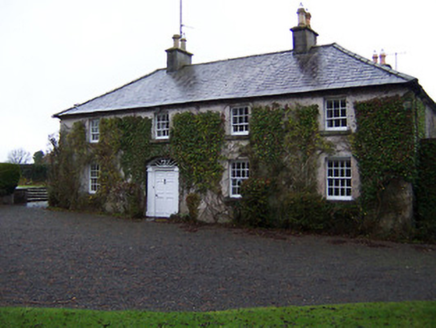 StonehallHouse · 956 yd
 Mortimer's CastleArchaeological place · 1.9 mi
 Children of Lir: Lough DerravaraghLegend location · 1.9 mi
Explorer Tom Children of Lir: Lough Derravaragh starts with four children becoming swans because Aoife could not bear sharing the attention. That is not a family argument I want to referee. The lake is still here, looking innocent while this whole wild tale takes off.
 Carrick CastleCastle · 3.7 mi
 Chinese GardenGarden · 4.0 miComputer-made picture
 Tibetan GardenGarden · 4.1 miComputer-made picture
 European Beech4.4 mi
 Pedunculate Oak4.6 mi
More archaeology and monuments in County Westmeath · All of County Westmeath

What do you know about this place?Tap to add a comment or ask a question