
What is recorded here
In improved pasture, on a very gentle WSW-facing slope. A rectangular area (dims. 33m NE-SW; 32m NW-SE) defined by a bank (Wth at top 3.5m; overall Wth 5.7m; int. H 0.5m; ext. H 0.45m) at NW and SE, reduced to scarp at SW and possibly incorporated into field boundary at NE, and a fosse (basal Wth 2.2m; overall Wth…
Read the whole record
From the National Monuments Service (Archaeological Survey of Ireland) record TS063-042
Places near here
Picture notes
- Computer-made picture. It does not show this monument.
- Mike Searle, Wikimedia Commons · CC BY-SA 2.0
- National Inventory of Architectural Heritage
- Computer-made picture. It does not show this playground.
- Steve & Jemma Copley on Flickr, Wikimedia Commons · CC BY-SA 2.0
- Willow, Wikimedia Commons · CC BY 2.5
- A.-K. D., Wikimedia Commons · CC BY-SA 4.0
- A.-K. D., Wikimedia Commons · CC0
- Computer-made picture. It does not show this walking route.
 Settlement cluster in KillaghySettlement cluster · 387 ydComputer-made picture. It does not show this monument.
Explorer Tom Settlement cluster in Killaghy has caught my eye in Killaghy, County Tipperary. I bet a settlement cluster with a name like that could keep me talking all afternoon; I'm already inventing a daft little scene for it, and I'll stop before it turns into history.
_(geograph_3037593).jpg/250px-Castles_of_Munster-_Killaghy,_Tipperary_(2)_(geograph_3037593).jpg "Photo: Mike Searle, Wikimedia Commons · CC BY-SA 2.0") Killaghy CastleCountry house · 489 yd
Killaghy CastleCountry house · 489 ydExplorer Tom Killaghy Castle has caught my eye in Killaghy, County Tipperary. I bet a country house with a name like that could keep me talking all afternoon; I'm already inventing a daft little scene for it, and I'll stop before it turns into history.
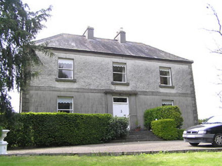 Oakfield HouseHouse · 627 yd
Explorer Tom Oakfield House has caught my eye in Beeverstown, County Tipperary. I bet a house with a name like that could keep me talking all afternoon; I'm already inventing a daft little scene for it, and I'll stop before it turns into history.
 Enclosure in BeeverstownEnclosure · 651 ydComputer-made picture. It does not show this monument.
Explorer Tom Enclosure in Beeverstown has caught my eye in Beeverstown, County Tipperary. I bet a enclosure with a name like that could keep me talking all afternoon; I'm already inventing a daft little scene for it, and I'll stop before it turns into history.
 Children's playground672 ydComputer-made picture. It does not show this playground.
Explorer Tom Children's playground has caught my eye in County Tipperary. I bet a children's playground with a name like that could keep me talking all afternoon; I'm already inventing a daft little scene for it, and I'll stop before it turns into history.
 Silver Fir2.2 mi
Explorer Tom Silver Fir has caught my eye in County Tipperary. I bet a silver fir with a name like that could keep me talking all afternoon; I'm already inventing a daft little scene for it, and I'll stop before it turns into history.
 European ash2.2 mi
Explorer Tom European ash has caught my eye in County Tipperary. I bet a european ash with a name like that could keep me talking all afternoon; I'm already inventing a daft little scene for it, and I'll stop before it turns into history.
 Killamery High CrossVisitor information · 3.9 mi
Explorer Tom Killamery High Cross has caught my eye in County Kilkenny. I bet a visitor information with a name like that could keep me talking all afternoon; I'm already inventing a daft little scene for it, and I'll stop before it turns into history.
 KillameryVisitor information · 3.9 mi
Explorer Tom Killamery has caught my eye in County Kilkenny. I bet a visitor information with a name like that could keep me talking all afternoon; I'm already inventing a daft little scene for it, and I'll stop before it turns into history.
 James (Jim) McKennaMemorial · 4.8 mi
Explorer Tom James (Jim) McKenna has caught my eye in County Kilkenny. I bet a memorial with a name like that could keep me talking all afternoon; I'm already inventing a daft little scene for it, and I'll stop before it turns into history.
 Bearna Breac LoopWalking route · 5.1 miComputer-made picture. It does not show this walking route.
Explorer Tom Bearna Breac Loop has caught my eye in County Kilkenny. I bet a walking route with a name like that could keep me talking all afternoon; I'm already inventing a daft little scene for it, and I'll stop before it turns into history.
 Ballinard CastleCastle, tower house · 5.2 mi
Explorer Tom Ballinard Castle has caught my eye in Ballinard, County Tipperary. I bet a castle, tower house with a name like that could keep me talking all afternoon; I'm already inventing a daft little scene for it, and I'll stop before it turns into history.
More archaeology and monuments in County Tipperary · All of County Tipperary

What do you know about this place?Tap to add a comment or ask a question