What is recorded here
In hilly pasture, on SSW-facing slope. Roughly circular area (147m N-S; 136m E-W) enclosed by earthen bank (H 1.8m); shallow external fosse to W; gateway to NW. Disused roadway bounds enclosure on E. Interior sub-divived by low earthen bank (max. H 1m) into three unequal parts. Burial ground (CO121-008002-) in NE…
Read the whole record
In hilly pasture, on SSW-facing slope. Roughly circular area (147m N-S; 136m E-W) enclosed by earthen bank (H 1.8m); shallow external fosse to W; gateway to NW. Disused roadway bounds enclosure on E. Interior sub-divived by low earthen bank (max. H 1m) into three unequal parts. Burial ground (CO121-008002-) in NE quadrant. Interior features: (1). Well in SW quadrant. (2). Just W of centre, circular area (diam. 8m) enclosed by grass-covered earth and stone bank (H 0.8m; Wth 2m) (CO121-085----). (3). In SW quadrant close to ESE bank, subrectangular area (16m N-S; 10m E-W) (CO121-084----) defined by earth and stone bank (H 0.6m), heavily overgrown. (4). Small mound (CO121-008003-) inside and joined to S bank by low rise. Concentration of metal slag at base of bank here.
From the National Monuments Service (Archaeological Survey of Ireland) record CO121-008001
Places near here
Photo credits
- National Inventory of Architectural Heritage
- Mike Searle, Wikimedia Commons · CC BY-SA 2.0
- SlaineMacRoth, Wikimedia Commons · CC BY-SA 4.0
- dougf, Geograph · CC BY-SA 2.0
- Mike Searle, Geograph · CC BY-SA 2.0
- Hywel Williams, Wikimedia Commons · CC BY-SA 2.0
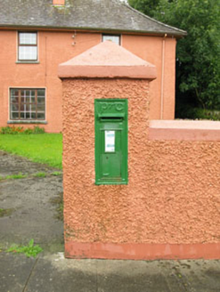 post box724 yd
 Bealanascartane BridgeBridge · 1.5 mi
_-_geograph.org.uk_-_3036684.jpg/250px-Castles_of_Munster,_Ballinvard,_Cork_(1)_-_geograph.org.uk_-_3036684.jpg "Photo: Mike Searle, Wikimedia Commons · CC BY-SA 2.0") Ballinvard CastleCastle · 1.8 mi
Ballinvard CastleCastle · 1.8 mi Sheela-na-gig in Ballynacarriga (carbery East (eastern Div.) By.)Sheela-na-gig · 1.8 mi
 Ballynacarriga CastleCastle, tower house · 1.8 mi
Explorer Tom Ballynacarriga Castle is a four-storey tower house overlooking the lough. It has a spiral stair, vaulted lobby, and murder hole. The top floor was used as a chapel later on. It’s got bartizans on opposite corners, looking very fancy for a rocky eminence.
 Mohona WoodWood · 3.7 miCorran HillMountain / peak · 3.7 miIrish National Forestry FoundationNature reserve · 3.8 miJeremiah O'Donovan RossaMemorial · 3.8 mi
 Fort RobertArchaeological place · 4.5 mi
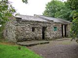 Michael Collins BirthplaceHistoric birthplace · 5.0 mi
 Michael Collins MemorialMemorial · 5.3 mi
More archaeology and monuments in County Cork · All of County Cork
What do you know about this place?Tap to add a comment or ask a question