
What is recorded here
Situated on a rise in a fairly low-lying area. It is not depicted on any edition of the OS 6-inch map but it is suggested by a curving field bank E-SW on the 1945 revision, and the rest of the perimeter is visible on aerial photographs (OS: 4/ 6746-7) and some later series. This is a grass and rush-covered circular platform (diam. 33m E-W; 31m N-S; H 0.8m) defined by a wet shallow fosse (Wth 3.5m; D 0.25m). An original entrance is not detected but the platform is surrounded by a field banks E-S-W.
The above description is derived from 'The Archaeological Inventory of County Leitrim' compiled by Michael J. Moore (Dublin: Stationery Office, 2003). In certain instances the entries have been revised and updated in the light of recent research.
Compiled by: Michael Moore
Date of revised upload: 15 October 2019
A local fairy fort (ringfort/rath); wider significance not recorded.
The monument record does not grant public access. Check the route and ask the landowner before entering private land.
- What survives
- Recorded monument
Places near here
 CastlecarraCastle, unclassified · 370 yd
 Enclosure in CloonmulliganEnclosure · 845 yd
 Enclosure in Clogher (leitrim By.),dromore (leitrim By.)Enclosure · 957 yd
 R. C. ChapelChurch · 1052 yd
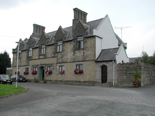 Summerhill Lodgeworkhouse administration block · 1652 yd
 Moon RiverHeritage attraction · 1.4 mi
 PortCastle, unclassified · 1.9 mi
 Patrick Gill Memorial Plaque (IRA)Monument · 2.8 mi
 Declaration of IndependenceMemorial · 2.8 mi
 Wildlife AreaNature reserve · 3.1 mi
 Leabaidh DermotCave · 3.5 mi
 Hughestown WoodForest · 3.7 mi
Other information
Photo: Credit not shown in the picture search · Rights wording not checked; contact us if this picture should be removed