What is recorded here
On the E bank of Kedrah Stream. The Civil Survey (1654-6) (Simington 1931, vol.1, 321) refers to 'a Well called Toburneglory' as a landmark along the 'parish of Mortlestowne', this may be the well now known as 'Toberanouraun'. The well used to pump water up to Kedrah House from the 1930s to the 1960s. A ram was inserted to pump water and in the 1960s the stream was fenced off. The well has since been quarried out with no visible trace at ground level. According to local information the well was called Tober an amhrán (Well of the song) and was reputedly the place where a mermaid sat and sang. The surrounding field was known as parc an amhrán.
On the E bank of Kedrah Stream. The Civil Survey (1654-6) (Simington 1931, vol.1, 321) refers to 'a Well called Toburneglory' as a landmark along the 'parish of Mortlestowne', this may be the well now known as 'Toberanouraun'. The well used to pump water up to Kedrah House from the 1930s to the 1960s. A ram was inserted to pump water and in the 1960s the stream was fenced off. The well has since been quarried out…
From the National Monuments Service (Archaeological Survey of Ireland) record TS075-029
This remains an important historical record, but the official description says the monument is no longer visible or has been destroyed. The monument record does not grant public access. Check the route and ask the landowner before entering private land.
- What survives
- No visible remains or recorded as destroyed
Places near here
Photo credits
- National Inventory of Architectural Heritage
- Sarah777, transferred by Lvova, Wikimedia Commons · Public domain
- Martin Richard Phelan, Geograph · CC BY-SA 2.0
- Mike Searle, Wikimedia Commons · CC BY-SA 2.0
- Andreas F. Borchert, Wikimedia Commons · CC BY-SA 4.0
- Chmouel Boudjnah Original uploader was Chmouel at fr.wikipedia, Wikimedia Commons · CC BY-SA 3.0
- Benutzer:StefanServos, Wikimedia Commons · CC BY-SA 3.0
- Algirdas at Lithuanian Wikipedia, Wikimedia Commons · Public domain
- Sitomon, Wikimedia Commons · CC BY-SA 2.0
Kedrah FortArchaeological place · 1084 yd Keylong HouseHouse · 1534 ydOutrath LodgeRectory/glebe/vicarage/curate's house · 1546 ydKnockgraffon MotteArchaeological place · 1.2 miKnockgraffon MoatCastle, motte and bailey · 1.3 miKnockgraffon CastleCastle · 1.3 miCaher AbbeyHeritage attraction · 2.0 miSiege of Cahir CastleSiege · 2.2 miCahir CastleCastle · 2.3 miPedunculate Oak3.1 miEuropean Yew3.4 miSlieveanard ne TopMountain / peak · 3.8 mi
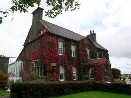 Keylong HouseHouse · 1534 yd
 Outrath LodgeRectory/glebe/vicarage/curate's house · 1546 yd
 Knockgraffon MotteArchaeological place · 1.2 mi
 Knockgraffon MoatCastle, motte and bailey · 1.3 mi
 Knockgraffon CastleCastle · 1.3 mi
 Caher AbbeyHeritage attraction · 2.0 mi
 Siege of Cahir CastleSiege · 2.2 mi
 Cahir CastleCastle · 2.3 mi
 Pedunculate Oak3.1 mi
 European Yew3.4 miSlieveanard ne TopMountain / peak · 3.8 mi
More archaeology and monuments in County Tipperary · All of County Tipperary
What do you know about this place?