Places near here
Photo credits
- Thommcg1980, Wikimedia Commons · CC BY-SA 4.0
- Irish Fireside, Wikimedia Commons · CC BY-SA 2.0
- Didier Descouens, Wikimedia Commons · CC BY-SA 4.0
- Nunulark, Wikimedia Commons · CC0
- Maker named on the Wikimedia Commons picture page · Public domain
- Wikimedia Commons contributor · Public domain
- Graham Horn, Geograph · CC BY-SA 2.0
- Ian Macnab, Geograph · CC BY-SA 2.0
- Marathon, Geograph · CC BY-SA 2.0
- N Chadwick, Geograph · CC BY-SA 2.0
 Derrycunihy Catholic ChurchChurch/chapel · 523 yd
Explorer Tom Derrycunihy Catholic Church is where a priest lost a bet involving a sausage roll and a copper-clad spirelet. Built around 1890, it’s now partly derelict and looks like it’s waiting for a rescue team that never arrives. The apse has a story it won’t tell unless you’re very thirsty. Best seen with a hangover and a sausage roll.
Derrycunihy Roman Catholic ChurchRuins · 525 ydExplorer Tom Derrycunihy Church would tell a teenager that the 1800s were basically just us with worse fashion choices and no Wi-Fi to complain about. It’s been standing here watching generations come and go, keeping its mouth shut about all the secrets it knows from back then. A proper spot for a flask of tea and a big think.
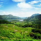 Ladies ViewViewpoint · 1429 yd
Explorer Tom Ladies View is a grand name for a roadside stop, but the scenery made Queen Victoria's ladies-in-waiting say so in 1861. I would have nodded along, then asked whether we could stay another hour. The viewpoint sits about nineteen kilometres from Killarney on the road toward Kenmare, overlooking water, woods and mountains in the national park. It has earned a long career in photographs, though no picture can quite hold the air and the changing light. I might claim to have advised the royal party where to stand, but I was late by more than a century. There is a small parking area and a café; the road also carries through traffic, so step out carefully and keep well clear of any drop. Take the view from the proper stopping place rather than trying to improve it by edging closer. The ladies had the right idea: pause, look, and let somebody else hurry on.
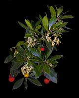 Strawberry tree1.4 mi
Explorer Tom The Strawberry tree in County Kerry is currently the subject of intense seagull gossip. They think it’s trying to steal their lunch, which is fair given its fruity reputation. Great spot to propose. Or at least to propose lunch.
 KnockrowerMountain / peak · 1.6 mi
Explorer Tom Knockroe in County Kerry would bring its own dislodged capstone to any party as a conversation starter. It’s like a rock that forgot how to sit down properly. Have a sandwich here and call it a heritage lunch.
 English holly2.4 mi
Explorer Tom English holly in County Kerry swears by the superstition that if you don’t kiss under it, you’ll trip over a root later. It’s got sharp teeth and an even sharper tongue. Bring sandwiches, the gulls will thank you.
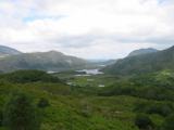 Killarney National ParkHeritage attraction · 2.4 mi
Explorer Tom Killarney made a whole park and expects you to pick just one path. Killarney National Park began in 1932 when the Muckross Estate was given to the Irish Free State, making this Ireland's first national park. It has since spread across more than 100 square kilometres of lakes, woods, bog and mountains, which is a lot of ground for one day's heroic ambitions. Lough Leane alone has more than 30 islands, while the native red deer herd is the only one left on mainland Ireland. Ancient oak and yew woods are part of the reason the park matters beyond its camera ready views. If I promise to see every lake today, tell me the daylight has other plans. You can follow public paths, visit lakeside spots or take a boat towards Innisfallen, but choose a route that suits the day and check any boat service separately. Keep a respectful distance from deer and stay on suitable paths through fragile ground. If you try to see the whole park at once, the park will win; pick one corner and let it surprise you.
 Torc Mountain W TopMountain / peak · 3.2 mi
Explorer Tom Torc Mountain W Top is where Saint Patrick supposedly went to hide from his own bad jokes for an entire afternoon. He sat there in silence, looking very uncomfortable, and swore he would never make another pun about frogs again. Perfect detour when the satnav has a meltdown.
 Meeting of the watersViewpoint · 3.6 mi
Explorer Tom Meeting of the Waters is where two rivers had a row and never quite made up, so they just stand there sulking while you take your photos. I heard King Charles visited once to mediate their dispute, but he got distracted by a seagull and left without saying a word. Pick a stone, any stone, and invent its biography.
 Bog BayBay · 3.6 mi
Explorer Tom Bog Bay is a bay that hears everything through its muddy walls because it’s got ears like a radar dish tuned in on every secret whispered along the shoreline. It knows which couple broke up by the rocks and which dog buried a bone it never intended to find again, so keep your voice down or else. Bring the dog, it’ll have opinions.
 Head of DunloeViewpoint · 3.7 mi
Explorer Tom Head of Dunloe in County Kerry handles its nosy neighbors by just turning its back on them and staring into the middle distance. It’s up at eight kilometers south of Beaufort, looking like it’s plotting something shady with the clouds above it. If anyone asks, Tom sent you.
 Muckross Lake WalkWalking route · 4.2 mi
Explorer Tom Muckross Lake Walk in County Kerry would teach history by making everyone stand in a puddle until they understood the concept of wetness and consequences properly. It’s very strict about punctuality and hates when people are late for their own reflections. Ideal for a moody photo you'll pretend wasn't posed.
More historic places in County Kerry · All of County Kerry

What do you know about this place?Tap to add a comment or ask a question