
What is recorded here
From the National Monuments Service (Archaeological Survey of Ireland) record CL048-040
Places near here
Photo credits
- National Inventory of Architectural Heritage
- Eddylandzaat, Wikimedia Commons · CC BY 3.0
- P L Chadwick, Wikimedia Commons · CC BY-SA 2.0
- Graham Horn, Geograph · Creative Commons Attribution-ShareAlike 2.0
- Tiger, Geograph · CC BY-SA 2.0
- Roger Diel, Geograph · CC BY-SA 2.0
- Charles W Glynn, Geograph · CC BY-SA 2.0
- GenesisNZ, Wikimedia Commons · CC BY-SA 4.0
- Simon Huguet, Wikimedia Commons · CC BY-SA 2.0
- Chris, Geograph · CC BY-SA 2.0
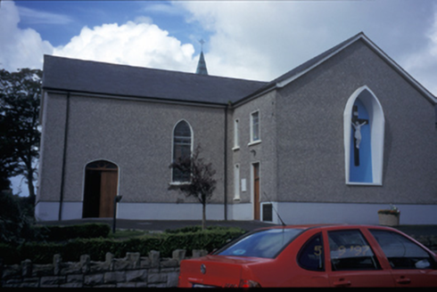 Catholic Church of Saint Michael the ArchangelChurch/chapel · 2.4 mi
Explorer Tom Catholic Church of Saint Michael the Archangel in Kilmihil has been teaching history lessons since 1834, probably while ignoring its students. Bring a pen pal, they'll be jealous, because this place has more character than your entire social media feed combined.
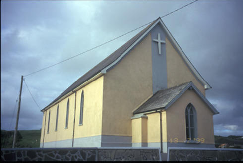 Catholic Church of the Most Holy RedeemerChurch/chapel · 5.8 mi
Explorer Tom Coor West’s Most Holy Redeemer church dates to 1865 and features a freestanding belfry nearby. Its timber traceried windows hint at the craftsmanship that shaped this important local landmark.
 SlievecallanMountain / peak · 7.2 mi
Explorer Tom Slievecallan, a mountain that’s as rugged as the winter landscape it’s dressed in during January.
 Clonderalaw BayBay · 8.3 mi
Explorer Tom Clonderalaw Bay offers a gentle curve of water in County Clare, perfect for spotting seabirds from the shore.
 Grave YardGraveyard · 8.8 mi
Explorer Tom Graveyard in Kilmaley is playing hide-and-seek with me. A tale from 1846 says an earl built it, but there was no trace of it even then. Bring a friend who talks too much and let the place shut them up.
 St Senan's WellSpring · 9.3 mi
Explorer Tom St Senan's Well marks his birthplace on the duck field. Born in 488 AD and still making waves today. Check for any ducks hanging around, they might be his ancestors in disguise.
 Tromra CastleCastle, tower house · 9.6 mi
Explorer Tom Tromra Castle overlooks Mutton Island from level marshy ground, which sounds like a bad dream. The wind probably picked on it because it stood too still for forty years. Look up, the best bit is always higher than you think, unless you fall in.
 Doughmore BeachBeach / strand · 9.8 mi
Explorer Tom Doughmore Beach offers great surf but shifting sands, so keep an eye out if you’re brave enough to paddle.
 Spanish Point BeachBeach / strand · 9.9 mi
Explorer Tom Spanish Point Beach is an extensive sandy stretch west of Milltown Malbay, though you’ll need to watch the bye-laws.
 Emlagh PointHeadland · 9.9 mi
Explorer Tom Emlagh Point is a headland in County Clare, perhaps offering a panoramic view of the bay and the western coastline ahead.
 Spanish PointVisitor information · 10 mi
Explorer Tom Spanish Point has me wondering if it's a place where the Spanish Armada once landed; the account doesn't say what's special about it.
 Caherrush Castle (in Ruins)Castle, tower house · 10 mi
Explorer Tom Caherrush Castle is probably being run by a fox who thinks he’s the landlord. It’s a tower house that’s seen better days and worse tenants. Pick a stone, any stone, and invent its biography as a famous pirate.
More archaeology and monuments in County Clare · All of County Clare

What do you know about this place?Tap to add a comment or ask a question