
What is recorded here
In generally flat topography. A square raised area (int. dims. 61m square; ext. dims. 74m square) defined by earthen bank (Wth 2-2.2m; int. H 0.3-0.5m; ext. H 2-c. 3m) with external fosse (Wth 2m; D 0.6m). The fosse has been largely infilled on the E, S and W sides, with a field boundary running along the N side.…
Read the whole record
From the National Monuments Service (Archaeological Survey of Ireland) record KK030-011
Places near here
Photo credits
- Maker not stated on source page, en.wikipedia.org
- Maker not stated on source page, allthatsinteresting.com
- Kieran Campbell, Geograph · CC BY-SA 2.0
- Maker not stated on source page, www.irishmirror.ie
- Maker not stated on source page, tr.pinterest.com
- Maker not stated on source page, ru.pinterest.com
- kevin higgins, Wikimedia Commons · CC BY-SA 2.0
- National Inventory of Architectural Heritage
- Didier Descouens, Wikimedia Commons · CC BY-SA 4.0
- Andy Ryan / 1803 Productions, credited by Kilkenny GAA, kilkennygaa.ie
- Willow, Wikimedia Commons · CC BY 2.5
 Croghtabeg Ringfort (rath)Archaeological place · 1338 yd
Explorer Tom Croghtabeg Ringfort has been picked on by the wind for centuries because it is round, which makes it an easy target for…
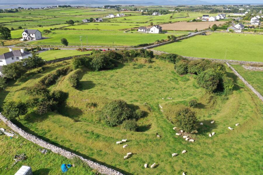 Fairy fort / earthen ringfort in Croghtabeg (bunbury)Fairy fort / earthen ringfort · 1343 yd
Explorer Tom Fairy fort / earthen ringfort in Croghtabeg is run by a dog who thinks he’s the head of security. The bank has gaps…
 Fairy fort / ringfort in CoolaghflagsFairy fort / ringfort · 1.1 mi
Explorer Tom Fairy fort / ringfort in Coolaghflags would be the uncle who eats all the food and says nothing. It sits there, dished…
 CastleCastle, unclassified · 1.1 mi
Explorer Tom Castle in Roscon started because two lads made a bet in a pub and lost their minds, or maybe just their keys. It’s…
 Kildrummy graveyardCemetery · 1.2 mi
Explorer Tom Kildrummy graveyard has strict rules about visitors: no loud chewing, no judging the headstones, and definitely no…
 Graveyard in KildrummyGraveyard · 1.2 mi
Explorer Tom Graveyard in Kildrummy is stuck in a fairy dispute over parking rights, so keep your car where it doesn't block the…
 Catholic Church of Our LadyChurch/chapel · 1.2 mi
Explorer Tom Catholic Church of Our Lady in Coolaghmore sits right on a crossroads where a local lad swears he invented the concept…
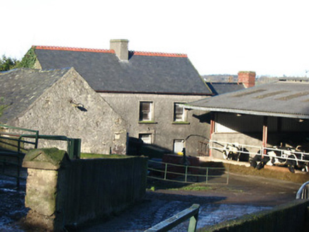 farm house1.3 mi
Explorer Tom Rossaneny Farm House has a secret talent for looking exactly like every other farm in County Kilkenny. It’s disused…
Fairy fort / ringfort in BarravallyFairy fort / ringfort · 1.4 miExplorer Tom Fairy fort / ringfort in Barravally has very strong opinions on modern buildings and thinks your smartphone looks like…
 Hawthorn1.4 mi
Explorer Tom Hawthorn gave up its thorns for Lent, but they grew back by Easter because it changed its mind completely. Now it’s…
 Windgap GAA pitchGAA ground · 1.7 mi
 European ash1.9 mi
Explorer Tom European ash is the kind of tree Saint Patrick would say 'that’s not a snake, it’s a branch' to. It stands tall but…
More archaeology and monuments in County Kilkenny · All of County Kilkenny

What do you know about this place?Tap to add a comment or ask a question