
What is recorded here
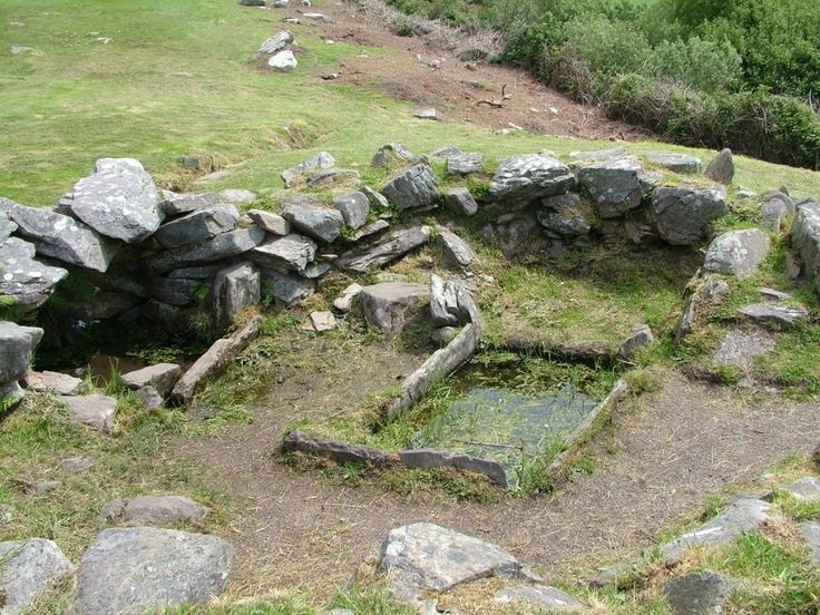
Indicated is a collapsed stone ringfort on the lower north-facing slope of Caherbarnagh in County Cork, where local tradition claims thread was once bleached. The rough moorland holds a circular wall with an eastern gap, a small chamber built against a southern rock outcrop, and a central mound that may mark another lost structure. People may have herded sheep inside the stones or worked flax in the open air before the wall crumbled into the ground.
In rough open moorland, on lower N-facing slope of Caherbarnagh. Circular area (29m E-W; 28.5m N-S) defined by collapsed stone wall (max. H 1.3m; T 1.2m). Gap (Wth 1.4m) in wall to E. Interior slopes down to N and is roughly strewn with stones; large rock outcrop on S side. Partially collapsed circular structure (3.6m N-S; 3.2m E-W; H 1.5m: wall T 2.3m) built against W side of outcrop; low NE-SW stone wall connects structure to SW side of main enclosure. Roughly circular mound of stones (10m E-W; 8m N-S; H 1m) in centre may indicate position of second collapsed structure. According to Broker (1937, 49), 'called Cathair an tSnaith, as thread was bleached here formerly. Stone structure put here only about 1806 to hold sheep'.
The above description is derived from the published 'Archaeological Inventory of County Cork. Volume 3: Mid Cork' (Dublin: Stationery Office, 1997). In certain instances the entries have been revised and updated in the light of recent research.
Date of upload/revision: 14 January 2009
The monument record does not grant public access. Check the route and ask the landowner before entering private land.
- What survives
- Recorded monument
Places near here
 Fulacht FiadhFulacht fia · 843 yd
 Caherbarnagh East TopMountain / peak · 1225 yd
 Fulacht fia in Gortavehy EastFulacht fia · 1637 yd
 CaherbarnaghMountain / peak · 1.2 mi
 Ballydaly Church (in Ruins)Church · 1.6 mi
 Church of Our Lady of Lourdeschurch/chapel · 2.0 mi
 Wildlife of the UplandsVisitor information · 3.4 mi
 Birds of DuhallowVisitor information · 3.5 mi
 Kilmeedy CastleCastle, tower house · 3.7 mi
 RowanRowan · 3.9 mi
 Millstreet Museum & Tourist Information CentreMuseum · 4.0 mi
 Nohaval WoodWood · 4.3 mi
Other information
Photo: Credit not shown in the picture search · Rights wording not checked; contact us if this picture should be removed