
Places near here
Photo credits
- National Inventory of Architectural Heritage
- https://wellcomeimages.org/indexplus/obf_images/9d/3a/d226702f3e0deddf6dc6f5d8e3e2.jpg Gallery: https://wellcomeimages.org/indexplus/image/M0006003.html Wellcome Collection gallery (2018-04-03): https://wellcomecollection.org/works/avsn99bm CC-BY-4.0, Wikimedia Commons · CC BY 4.0
- Maker not stated on source page, blog.irishtourism.com
- Maker not stated on source page, commons.wikimedia.org
- N Chadwick, Geograph · CC BY-SA 2.0
- Anne Burgess, Wikimedia Commons · CC BY-SA 2.0
- N Chadwick, Wikimedia Commons · CC BY-SA 2.0
- Oliver Dixon, Geograph · CC BY-SA 2.0
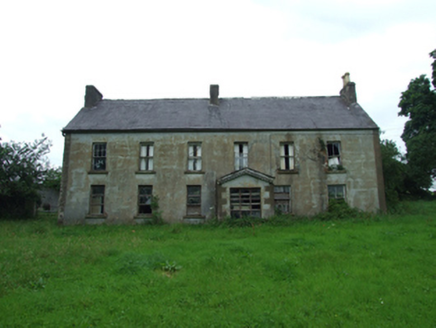 Upper Thornhill HouseHouse · 699 yd
Explorer Tom Upper Thornhill House in County Cavan is showing off its timber shutters like they won an award. It’s got a stone…
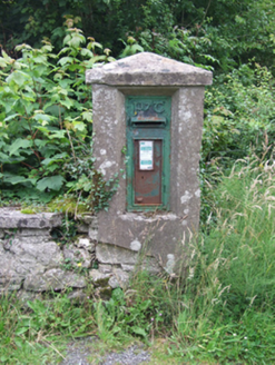 post box863 yd
Explorer Tom Post box in Thornhill or Mullandreenagh has a retirement plan involving becoming a very expensive garden ornament for a…
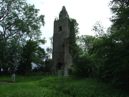 Largy Church of Ireland ChurchChurch/chapel · 983 yd
Explorer Tom Largy Church of Ireland Church in Thornhill was destroyed by the Night of the Big Wind in 1839, which is basically…
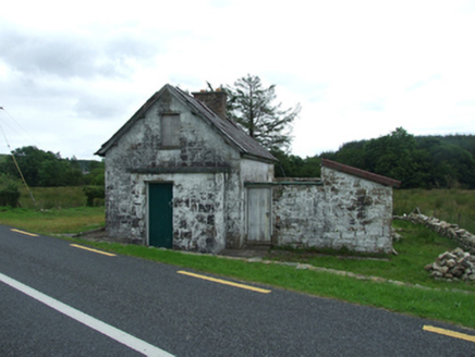 worker's house1134 yd
Explorer Tom Worker's house in Killycarney was built for a level crossing keeper on a railway that no longer exists. It’s basically…
 Bullans stoneBullaun stone · 1.0 mi
Explorer Tom Bullans stone in Termon is where a priest once lost a bet to a farmer over whether the holes were natural or magical…
 Kilrooskagh IslandIsland · 1.3 mi
Explorer Tom Kilrooskagh Island looks like someone accidentally dropped a potato in the lough and forgot to pick it up. The builder…
 Stone EnclosureStone enclosure, cashel? or sheepfold? · 1.5 mi
Explorer Tom Stone Enclosure in Kilrooskagh is being guarded by one very stubborn bird who refuses to leave the roof. Is it a cashel…
 BurrenMountain / peak · 2.4 mi
Explorer Tom If Burren walked into a chipper, it would order the lot with extra vinegar and complain that the fries weren't crispy…
 Cavan BurrenVisitor attraction · 2.5 mi
Explorer Tom Cavan Burren is rocky, crumbly, and looks like someone dropped a giant bag of gravel and left. The first owner probably…
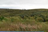 Cavan Burren ParkForest · 2.6 mi
Explorer Tom Cavan Burren Park is what happens when a landscape refuses to choose between a history book and a geology lesson. On…
 Marble ArchNatural arch · 5.2 mi
Explorer Tom Marble Arch has a secret it would definitely spill after three pints of stout at the local pub nearby. It’s been…
 Cuilcagh Mountain ViewpointVisitor information · 5.3 mi
Explorer Tom Cuilcagh Mountain Viewpoint is playing hard to get, claiming a rainbow is its only valid passport stamp. The hero who…
More archaeology and monuments in County Cavan · All of County Cavan

What do you know about this place?Tap to add a comment or ask a question