
What is recorded here
From the National Monuments Service (Archaeological Survey of Ireland) record SL005-058
Places near here
Photo credits
- Maker not stated on source page, commons.wikimedia.org
- Cliffoney, Wikimedia Commons · CC BY-SA 4.0
- National Inventory of Architectural Heritage
- Maker not stated on source page, www.dreamstime.com
- Gordon Hatton, Geograph · CC BY-SA 2.0
- Maker not stated on source page, www.tripadvisor.ca
- Michael Murtagh, Geograph · CC BY-SA 2.0
- Maker not stated on source page, fi.pinterest.com
- John M, Wikimedia Commons · CC BY-SA 2.0
- Oliver Dixon, Geograph · CC BY-SA 2.0
 Enclosure in KilcatEnclosure · 1503 yd
Explorer Tom Enclosure in Kilcat is strictly run by a very serious terrier who barks at anyone who looks too happy or too sad. He…
 Court tomb in GortnaleckCourt tomb · 1689 yd
Explorer Tom Court tomb in Gortnaleck would win the county fair for best display of ancient stone architecture without even trying.…
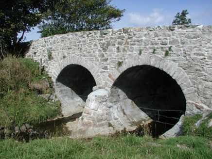 bridge1.2 mi
Explorer Tom Bridge in Drumfad gave up eating cars for Lent and now it’s showing off its semi-circular cutwaters as a sign of…
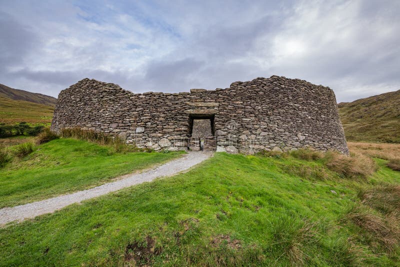 Fairy fort / stone ringfort in CastlegowanFairy fort / stone ringfort · 1.2 mi
Explorer Tom Fairy fort / stone ringfort in Castlegowan has strong opinions on modern buildings. It’s got square limestone blocks at…
 BenwiskinMountain / peak · 1.6 mi
Explorer Tom Benwiskin smells like wet wool and regret if you ask me. It’s got 'Private Keep Out' signs everywhere, which is…
 Graveyard in MoneygoldGraveyard · 1.9 mi
Explorer Tom Graveyard in Moneygold once sparked a massive parish argument over who owned the best plot of dirt. The whole village…
 Church in MoneygoldChurch · 1.9 mi
Explorer Tom Church in Moneygold would teach history by simply sitting there and refusing to explain anything. The name suggests…
 Kings MountainMountain / peak · 3.3 mi
Explorer Tom Kings Mountain in County Sligo was saved by a hero so obscure even his own ghost forgets his name. It stands tall over…
 Culleen WoodForest · 4.4 mi
Explorer Tom Culleen Wood was once offered to a cow who tried to buy it with three apples and a very confident moo. The farmer…
Gortaway WoodForest · 4.7 miExplorer Tom Gortaway Wood is constantly being picked on by the wind because it stands too close to the open moorland for its own…
 Glencar WaterfallVisitor information · 5.4 mi
Explorer Tom Glencar Waterfall would survive a zombie attack by just standing there and splashing them. It’s got more stamina than…
 Glencar IslandIslet · 5.5 mi
Explorer Tom Glencar Island in County Leitrim would complain to the council about the noise levels from the swans, claiming they’re…
More archaeology and monuments in County Sligo · All of County Sligo

What do you know about this place?Tap to add a comment or ask a question