
Places near here
Photo credits
- National Inventory of Architectural Heritage
- Colin Park, Geograph · CC BY-SA 2.0
- Rwxrwxrwx at English Wikipedia, Wikimedia Commons · Public domain
- Kevin O'Brien 13, Wikimedia Commons · CC BY-SA 4.0
- kevin higgins, Geograph · CC BY-SA 2.0
- Picture: Pinterest photograph
- Didier Descouens, Wikimedia Commons · CC BY-SA 4.0
- Mike Searle, Geograph · CC BY-SA 2.0
- Jean-Pol GRANDMONT, Wikimedia Commons · CC BY 3.0
 Catholic Church of Saint Helena of the CrossOfficially recorded historic building · 1270 yd
Explorer Tom Catholic Church of Saint Helena of the Cross in Glennanore is where the map makers completely lost their minds. They drew it looking like a sandcastle made of different colours, and honestly, that’s exactly what it looks like from the road. The polychromatic effect is so strong it practically glows at sunset.
 Historic buildingOfficially recorded historic building · 1307 yd
Explorer Tom Historic building in Glennanore is a post box that thinks the mailman owes it money. It’s got a royal cipher on it, which is impressive until you realize it’s basically a very judgmental tin can. Tell
 KnockanaffrinMountain / peak · 1.6 mi
Explorer Tom Knockanaffrin refuses to fall down because it knows gravity is a suggestion, not a rule. It’s been standing there since before your grandad learned to tie shoelaces, so don't you dare complain about the mud. Visit, then text me what you think. I'll pretend to read it.
 KnocksheegownaMountain / peak · 1.7 mi
Explorer Tom Knocksheegowna has a curse that only affects people who don't wave when they pass by. You have to be polite or you'll trip over roots for a week afterwards. It's very particular about manners and etiquette up there. If it rains, blame me.
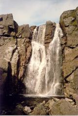 Mahon FallsWaterfall · 4.2 mi
Explorer Tom Mahon Falls is supposedly the escape route used by a local chieftain who fled his creditors in a canoe. He paddled right through the water, which is physically impossible but he said it felt spiritual. If anyone asks, Tom sent you.
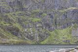 CoumshingaunMountain corrie and lake · 4.3 mi
Explorer Tom Coumshingaun is the result of two lads betting in a pub that they could dig a lake big enough to drown their bad luck. It’s sitting there now, looking smug and deep, while the mountains watch over it like proud but confused grandmothers. Tell me if the gossip I made up is true.
 Mahon ValleyCliff · 4.5 mi
Explorer Tom Mahon Valley witnessed a love story that went badly wrong because one partner brought a sausage roll. The other one got jealous of the bread, and now they both live there. Best seen with a hangover and a sausage roll.
 Carey's CastleCastle · 5.2 mi
Explorer Tom Carey's Castle in County Waterford has survived everything except your average zombie apocalypse, mostly because they’re too slow to get through the door. The entrance is still standing and judging your posture. Look serious, nod slowly, you're basically an expert now.
 Hawthorn5.5 mi
Explorer Tom Hawthorn in County Waterford would win a county fair easily because it just looks so effortlessly put together all the time. Its flowers are basically nature’s way of saying 'look at me, I’m doing my best.' Perfect place to be dramatically windswept.
 Ballyclohy Castle (in ruins)Castle, tower house · 5.7 mi
Explorer Tom Ballyclohy Castle thinks Dublin tourists are all talk and no walk, which is annoyingly true. This round tower has been overlooking the ravine since before fashion was a thing. Bring the dog, it'll have opinions.
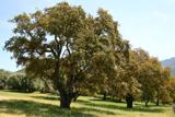 Cork oak5.7 mi
Explorer Tom Cork oak in County Tipperary sounds like a cello being played by someone who is really angry at their landlord during the quiet hours of the night. It’s got this thick, bumpy bark that looks like it’s been through centuries of arguments with the weather and won most of them. Pack a picnic and an excuse.
 Streches IslandIsland · 6.2 mi
Explorer Tom Streches Island started because two lads made a bet in the pub about whether they could name a rock before the next pint was finished. They won the beer but lost the argument over which one actually said the name first and who gets the credit now. Linger, it's not going anywhere and neither should you.
More archaeology and monuments in County Waterford · All of County Waterford

What do you know about this place?Tap to add a comment or ask a question