
Places near here
Photo credits
- Mick Garratt, Wikimedia Commons · CC BY-SA 2.0
- National Inventory of Architectural Heritage
- Eric Jones, Geograph · CC BY-SA 2.0
- EamonnPKeane at English Wikipedia, Wikimedia Commons · Public domain
- Graham Horn, Geograph · CC BY-SA 2.0
- A.-K. D., Wikimedia Commons · CC0
- Keith Salvesen, Geograph · Creative Commons Attribution-ShareAlike 2.0
- Oliver Dixon, Geograph · CC BY-SA 2.0
- Colin Park, Geograph · CC BY-SA 2.0
 Ben GoramMountain / peak · 949 yd
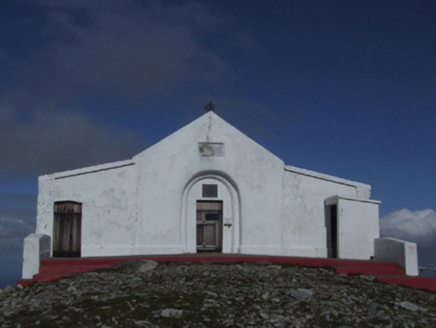 Saint Patrick's Catholic OratoryChurch/chapel · 1.5 mi
 Leaba PatrickMemorial · 1.5 mi
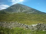 Croagh PatrickMountain / peak · 1.5 mi
Explorer Tom Fancy a gentle stroll to a chapel? The Reek is laughing already. Croagh Patrick rises like a pointed challenge above Clew Bay, but the people coming here had reasons long before the summit chapel. Nearby Boheh Stone carries more than 260 prehistoric carvings. From that stone, the setting sun seems to roll down the mountain's slope in late April and late August; that is a trick of position and light, and I would happily miss my tea to see it. I might offer Patrick a lift, but he would still have to push me uphill. Tradition says Patrick spent forty days fasting on the Reek. A chapel has stood on the summit since early Christian times, while the present one was dedicated in 1905. On the last Sunday in July, pilgrims still make the climb for Reek Sunday. The usual route begins near Murrisk, but this is a 764 metre mountain, not a chapel with a convenient lift. Bring boots, check the weather and give the pilgrims room. I may be a Donegal chancer, but I will not bargain with a Mayo mountainside.
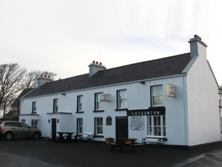 T. StauntonFarm house · 2.0 mi
 Croagh Patrick Pilgrim TrailWalking route · 2.6 mi
 Crott MountainMountain / peak · 3.0 mi
 National Famine MemorialHeritage attraction · 3.0 mi
 Graveyard3.0 mi
Explorer Tom Graveyard in Kilgeever hates the bumpy road leading to it. The ground keeps settling, so the headstones are always tilting like they’re judging your driving. Bring a flask of something warm and a story to swap.
 Old Head BeachBeach / strand · 3.1 mi
 InishdaughIslet · 4.0 mi
 InishleagueIslet · 4.1 mi
More archaeology and monuments in County Mayo · All of County Mayo

What do you know about this place?Tap to add a comment or ask a question