What is recorded here
Indicated is a boundary mound in Glen Lower,slievemore OR Kingsmountain, County Sligo, Ireland. The mounds extend 1.2km across an undulating terrace above mountain pasture and Glencar Lake. They appeared as dots on the 1837 Ordnance Survey map and carried the name Mound on the 1913 map. They are probably post 1700 AD features.
The eleventh of twelve features (SL009-002001-; SL009-002002-; SL009-002003-; SL009-002004-; SL009-002005-; SL009-002006-; SL009-002007-; SL009-002008-; SL009-002009-; SL009-002010-; SL009-002011-; SL009-002012-), each indicated with a dot on the OS 1837 edition of the OS 6-inch map. On the 1913 map each bears the designation 'Mound'. They are positioned along the border of Slievemore or Kingsmountain and a series of adjoining townlands to the S. The boundary mounds extend for a total of 1.2km along an undulating S-facing terrace, in elevated mountain pasture overlooking Glencar Lake to the SE. Views are panoramic from E-S-W and but elsewhere obscured by the summit of King's Mountain. In 1991 a fieldworker dismissed these potential monuments as 'clearance cairns' (SMR file). When visited in 2004 no remains were identified (SMR file). These are probably post 1700 AD features.
Compiled by: Patrick F. O'Donovan
Date of upload: 01 August 2012
The monument record does not grant public access. Check the route and ask the landowner before entering private land.
- What survives
- Recorded monument
Places near here
 Gleniff Barytes MineRuins · 1575 yd
 Noble 6 MonumentMonument · 1711 yd
 Glencar Lough ViewpointViewpoint · 1.3 mi
 Enclosure in LislahellyEnclosure · 1.3 mi
 Kings MountainMountain / peak · 1.3 mi
 Annacoona TopMountain / peak · 1.5 mi
 Dermot & Grania's BedCave · 1.9 mi
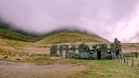 Gleniff School RuinsRuins · 2.0 mi
 Glencar WaterfallVisitor information · 2.2 mi
 Doneen WestCliff · 2.2 mi
 BenbulbenMountain · 2.3 mi
 Glencar IslandIslet · 2.3 mi