
Places near here
Photo credits
- National Inventory of Architectural Heritage
- Sitomon, Wikimedia Commons · CC BY-SA 2.0
- Vadim Manuylov, Wikimedia Commons · CC BY-SA 3.0
- A.-K. D., Wikimedia Commons · CC BY-SA 4.0
- Sarah777 at English Wikipedia, Wikimedia Commons · Public domain
- Internet Archive identifier : jstor-30002950 https://archive.org/download/jstor-30002950/30002950.pdf IA contributor: JSTOR, Wikimedia Commons · Public domain
- Seanief1, Wikimedia Commons · CC BY-SA 4.0
- Carroll Pierce, Geograph · CC BY-SA 2.0
- 瑞丽江的河水, Wikimedia Commons · CC BY-SA 4.0
- Alan James, Geograph · CC BY-SA 2.0
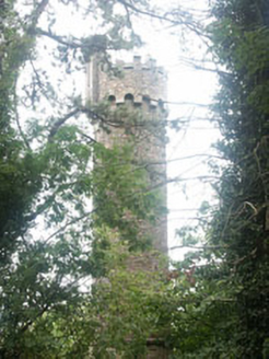 HollybrookFolly · 546 yd
Explorer Tom Hollybrook in County Wicklow was designed by a mother-in-law who wanted a tower just to keep an eye on everyone. It’s a romantic folly that looks like it grew out of the ground rather than being built. Just wave at it from a distance and hope it doesn’t start critiquing your shoes.
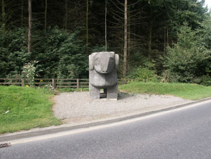 The Ram""Monument · 635 yd
Explorer Tom The Ram in Wingfield is a sculpture so confident it looks like it’s about to butt heads with the clouds. It’s basically the wedding guest who wears a tuxedo but dances like he’s naked. Wave at it from a safe distance, because this stone ram has zero patience for slow walkers.
 European Yew1254 yd
Explorer Tom European Yew in County Wicklow once had a poet fall into a ditch nearby while trying to get an angle for his epic. He came out with mud on his face and a new stanza about rotting wood. Great spot to propose. Or at least to propose lunch.
 Monterey Cypress1346 yd
Explorer Tom Monterey Cypress in County Wicklow was planted by a builder who was really just thinking about his lunch break at the time. He didn't check the soil or anything, he just hoped for the best and walked away. Bring a friend who talks too much and let the place shut them up.
 Grave YardGraveyard · 1579 yd
Explorer Tom Graveyard in Kilmacanoge South would get 'Finally some peace' on its tombstone because it’s had enough of the stream running past all day long. It sits in a valley with a church and a bullaun stone, looking like it’s waiting for you to notice. Stick around for the light changing, it's a show.
 Little Sugar LoafMountain / peak · 1.0 mi
Explorer Tom Little Sugar Loaf is what Saint Patrick would have called 'a bit much' when he saw its pointy little head sticking up near Bray. It’s essentially a big stone tooth that never got pulled. Take the long way round, it deserves the effort.
_(cropped).jpg/250px-Old_Court,_County_of_Wicklow_(IA_jstor-30002950)_(cropped).jpg "Photo: Internet Archive identifier : jstor-30002950 https://archive.org/download/jstor-30002950/30002950.pdf IA contributor: JSTOR, Wikimedia Commons · Public domain") Oldcourt CastleCastle · 1.0 mi
Oldcourt CastleCastle · 1.0 miExplorer Tom Oldcourt Castle in County Wicklow is being haunted by a pigeon who refuses to leave because he thinks it’s his ancestral home now. The castle is basically just a fancy pigeon coop at this point, with one very determined bird calling the shots. Find the date carved somewhere and feel clever.
 Cross1.3 mi
Explorer Tom The Cross in Fassaroe makes a distinct creaking sound at night that sounds suspiciously like it’s complaining about the damp. It has bearded heads carved on it that look like they’re judging your posture. Ideal place to rehearse an excuse for being late.
 The Sugar Loaf WayWalking route · 1.9 mi
Explorer Tom The Sugar Loaf Way in County Wicklow has very strong opinions on modern buildings and thinks they’re all a bit too square for its taste. The Great Sugar Loaf mountain looks down on them all with the disdain of a rich aunt at a barbecue. Stand still and listen, the wind tells it better than me.
 Bray HeadMountain / peak · 1.9 mi
Explorer Tom Bray Head has a cross on top and a railway clinging to the coast below. I would complain about the climb, but local people make it as a Good Friday procession, so I can manage a quieter pace. The headland reaches about 241 metres; its concrete cross went up in 1950. Some of the hill itself went away to help build Dún Laoghaire's pier, which is a fairly grand way to donate stone. Isambard Kingdom Brunel's railway took the cliff-side route below, then had to be diverted three times when the coast objected. I would have asked the rock for permission first, though it likely would have ignored me. A path from near Bray Esplanade climbs to the cross over rougher ground after the first steps. Check local trail conditions and stay back from drops. The view over town and sea is fine payment for a little honest effort.
 Great Sugar LoafMountain · 2.0 mi
Explorer Tom Great Sugar Loaf is named because someone in the pub bet two lads they couldn’t eat a whole loaf of bread, which seems like a stretch given its size. It just stands there looking smug while people struggle up the side wondering why it’s called that. Pop by and tell it it's looking well.
 Great SugarloafMountain / peak · 2.0 mi
Explorer Tom Great Sugarloaf has a hidden message carved in its stones that just says 'Nice shape,' which is oddly specific and a bit vain. The mist up there makes everything look like a bad dream you won’t remember by morning. Ideal stop for a big stretch and a bigger yawn.
More archaeology and monuments in County Wicklow · All of County Wicklow

What do you know about this place?Tap to add a comment or ask a question