
What is recorded here
From the National Monuments Service (Archaeological Survey of Ireland) record KE091-018001
Places near here
Photo credits
- Maker not stated on source page, pl.fusedlearning.com
- Maker not stated on source page, www.pinterest.com
- Maker not stated on source page, www.irelandhighlights.com
- Maker not stated on source page, www.alamy.com
- Maker not stated on source page, tr.pinterest.com
- Maker not stated on source page, ru.wikipedia.org
- Colin Park, Geograph · CC BY-SA 2.0
- National Inventory of Architectural Heritage
- Maker not stated on source page, www.interment.net
 Fairy fort / earthen ringfort in TooreennafershaFairy fort / earthen ringfort · 995 yd
Explorer Tom Fairy fort / earthen ringfort in Tooreennafersha was once ruled by a goat who ate all the maps. Now nobody can find it…
 Fairy fort / earthen ringfort in Gearha NorthFairy fort / earthen ringfort · 1021 yd
Explorer Tom Fairy fort / earthen ringfort in Gearha North has a ghost that’s too lazy to haunt it properly. It overlooks two rivers…
 Standing stone in Derrygarrane SouthStanding stone · 1342 yd
Explorer Tom Standing stone in Derrygarrane South is secretly proud of that potato it grew last winter, tilting north just to show…
 Ogham stone in Derrygarrane SouthOgham stone · 1548 yd
Explorer Tom Ogham stone in Derrygarrane South is playing hard to get. It got smashed up by treasure hunters back in the day, so…
 Stone row in DerrylickaStone row · 1554 yd
Explorer Tom Stone row in Derrylicka refuses to fall down because one stone is lying flat just to make the others work harder.…
 Enclosure in Derrygarrane SouthEnclosure · 1.1 mi
Explorer Tom Enclosure in Derrygarrane South keeps secrets for after a few pints. It’s built right into the rock outcrop of…
 Enclosure in Gortacloghane (dunkerron South By.)Enclosure · 1.2 mi
Explorer Tom Enclosure in Gortacloghane is actually a fionnán, which means the seagulls are judging your pronunciation right now.…
 KnocklomenaMountain / peak · 1.9 mi
Explorer Tom Knocklomena is famous for having no paths, which means it’s basically a giant tussocky obstacle course for your ankles.…
 Stumpa Duloigh se TopMountain / peak · 3.2 mi
Explorer Tom Stumpa Duloigh se Top claims a local invented it just to confuse tourists who can’t read maps. He swears he drew it…
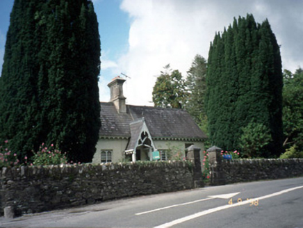 Blackwater CottageHouse · 3.6 mi
Explorer Tom Blackwater Cottage hosted the most dramatic event in history when a cat knocked over a vase. The decorative fascia and…
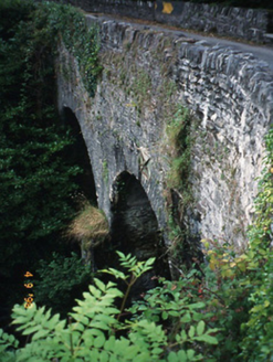 Blackwater BridgeBridge · 3.6 mi
Explorer Tom Blackwater Bridge would explain the 1800s to a teenager as just a really long queue for tea. The pedestrian refuge is…
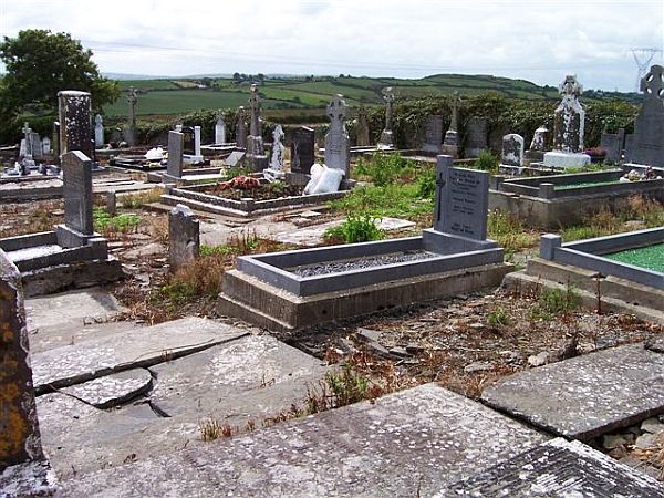 Incharue CemeteryCemetery · 5.2 mi
Explorer Tom Incharue Cemetery is incredibly proud of its single most impressive headstone, which I haven't seen yet but I'm sure…
More archaeology and monuments in County Kerry · All of County Kerry

What do you know about this place?Tap to add a comment or ask a question