DDiscover AloneMapAbout

Bawn in Garrynamann Lower

Bawn

This remains an important historical record, but the official description says the monument is no longer visible or has been destroyed. The monument record does not grant public access. Check the route and ask the landowner before entering private land.

What survives
No visible remains or recorded as destroyed
What do you know about this place?Tap to add a comment or ask a question

What you write will be public.

What is recorded here

On top of a glacial deposit on a flat island with Kings River c. 80m to N-NE and a steam which flows from Kings River to the W and runs 20m S of the motte and bailey (KK027-029001-) before rejoining Kings River to the SE. The bailey is raised above the island, which is probably liable to flood. The ground around the…

Read the whole record
On top of a glacial deposit on a flat island with Kings River c. 80m to N-NE and a steam which flows from Kings River to the W and runs 20m S of the motte and bailey (KK027-029001-) before rejoining Kings River to the SE. The bailey is raised above the island, which is probably liable to flood. The ground around the base of the bailey was formerly marshy but has been reclaimed (Ó Drisceoil 2006, 262). There are good views E and W along valley floor, but otherwise the view is impeded by rising ground to N and S of the rivers. The bawn follows the perimeter of an earlier bailey which adjoins a motte. The motte and bailey was probably built by Geoffrey FitzRoberts in 1192-3 when he founded the town of Kells (Empey 1984, 36). Early 13th-century references to the ‘castelli’ at Kells are likely to relate to the castle on the motte which was probably timber (ibid, 36-7). An inquisition of 1621 mentions the ‘fortilagium’ of Kells which may relate to the bawn (ibid., 37). The FitzRobert lordship ended c. 1308-1312, passing to a succession of absentee lords in the 14th century, including le Poers, Berminghams and Prestons and then in the 15th century to Thomas Butler, prior of Kilmainham and his heirs and in the 16th and 17th centuries to the Viscounts Mountgarret (ibid.). The bailey extends westward from the motte, running from the SW quadrant of the motte and presumably from the N-NW quadrant, though this area has been levelled. The bailey is formed by a raised platform defined by scarp (H 1.85m; Wth 3-5.2m) from W-N. The SE and SW perimeters of the bailey are defined by a later bawn wall. The bawn wall (H 4-5m; Wth 0.85-0.9m), built of roughly coursed limestone rubble, survives in two lengths. The section in the SE quadrant runs WNW-ESE (L 8.4m) before turning ENE-WSW (L 11.5m), the remaining length of wall between this wall and the motte is a more modern wall. There is a gap of 21m between the SE and SW section of wall. The SW wall changes direction several times to follow the perimeter of the bailey. The most southerly section (L 11.7m) incorporates the gable of a later building. This gable projects externally (L 1.63m) from the bawn wall and is not keyed into the bawn wall which appears to have been broken out to accommodate the building. An opening has been broken through the gable at ground-floor level. At first-floor level there are three narrow loops (H c. 1m; Wth 0.8-0.9m) within slightly splayed embrasures. The first-floor was vaulted over, though only the lower portion of the vault survives spring from the side walls (L 0.9m surviving internally). This building may be that referred to on the 1st ed. 6-inch OS map as 'Site of Gaol'. At a distance of 1.7m E of this building the bawn wall turns NW-SE (L14.5m) before turning N-S (L 5.2m). The wall is broken off at after this point. In the short section of N-S wall at this angle a crude broken out doorway had been broken through. There are put-log holes all along the wall, visible both internally and externally. The ground level within the bailey/bawn slopes to the NW and is undulating. There is no visible trace at ground within the bawn of a masonry castle (KK027-029002-), which may have been built contemporaneously with the bawn. The edge in the NE quadrant has been destroyed, probably when the T-plan church was built. The wall which currently runs along the NE quadrant is relatively modern Compiled by: Jean Farrelly Date of upload: 16 November 2017

From the National Monuments Service (Archaeological Survey of Ireland) record KK027-029003

Places near here

Photo credits
  • Charles Vallancey, Rev Joseph Turner (Life time: died 1812 / 1835), Wikimedia Commons · Public domain
  • Eirian Evans, Geograph · CC BY-SA 2.0
  • National Inventory of Architectural Heritage
  • Martin Richard Phelan, Wikimedia Commons · CC BY-SA 2.0
  • Maker not stated on source page, www.flickr.com
  • Maker not stated on source page, focusedcollection.com
  • Andreas F. Borchert, Wikimedia Commons · CC BY-SA 4.0
  • Dave Henderson, Wikimedia Commons · CC BY-SA 2.0
  • A.-K. D., Wikimedia Commons · CC BY-SA 4.0
  • Maker not stated on source page, en.wikipedia.org
CastleCastle, motte and bailey · 50 yd

Explorer Tom This motte and bailey in Garrynamann Lower would handle a nosey neighbour by simply sinking into the marshy ground and…

Kells BridgeBridge · 120 yd

Explorer Tom Kells Bridge has nine arches on one side and five on the other because someone widened it and forgot the math. It hates…

water pump121 yd

Explorer Tom This water pump in Goodwinsgarden would explain the 1800s to a teenager by saying, “We drank from this and didn’t have…

Kells Priory Mill MuseumMuseum · 189 yd

Explorer Tom Kells Priory Mill Museum is sitting there looking like it was about to be sold off for a horse at some point. It's been…

Lacken WellSpring · 368 yd

Explorer Tom Lacken Well near Kells is famous for the superstition that if you kiss the stone three times, your ex will call you…

Kells Loop WalkWalking route · 394 yd

Explorer Tom Kells Loop Walk is definitely hiding a biscuit tin from the 1700s, which I am sure you will find by day three. It runs…

Fairy fort / ringfort in Garrynamann LowerFairy fort / ringfort · 576 yd

Explorer Tom Fairy fort / ringfort in Garrynamann Lower claims to be best friends with a local celebrity, though I suspect it’s just…

Mapped graveyardGraveyard · 608 yd

Explorer Tom This Mapped graveyard in County Kilkenny survived a massive storm by pretending it wasn’t there at all. It’s been…

Water TowerCastle · 632 yd

Explorer Tom Water Tower in County Kilkenny thinks it's still holding back the flood of gossip from 1200. It’s guarding the monastic…
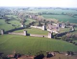
Kells Augustinian PrioryArchaeological place · 636 yd

Explorer Tom Kells Priory looks as though its monks expected to be asked for the keys to a fortress. Tower houses rise along the…

Font in Glebe (kells By.)Font · 783 yd

Explorer Tom Font in Glebe in Kilkenny is playing musical chairs with its own history, moving from church to cathedral to this spot…

Saint Mary's GraveyardGraveyard · 909 yd

Explorer Tom Saint Mary's Graveyard in County Kilkenny would be a terrible history teacher because it only talks about who died when…

More castles and forts in County Kilkenny · All of County Kilkenny

Add to this placeAdd a picture Add a detailed tip Add a story

Explore the map1,095,414 places to discover

Next place · or swipeCastle