
What is recorded here
Castle, unclassified in Garrynamann Lower stands on a raised island where marshy ground has been reclaimed, with Kings River nearby and a stream looping past the bailey. Geoffrey FitzRoberts probably built the motte and bailey in 1192 or 1193 when founding Kells, creating a timber stronghold that later became a bawn and perhaps a masonry castle. The land still holds low mounds and hollows, while absent lords and changing ownership faded from the place.
On top of a glacial deposit on a flat island with Kings River c. 80m to N-NE and a steam which flows from Kings River to the W and runs 20m S of the motte and bailey (KK027-029001-) before rejoining Kings River to the SE. The bailey is raised above the island, which is probably liable to flood. The ground around the base of the bailey was formerly marshy but has been reclaimed (Ó Drisceoil 2006, 262). There are good views E and W along valley floor, but otherwise the view is impeded by rising ground to N and S of the rivers.
The bawn follows the perimeter of an earlier bailey which adjoins a motte (KK027-029001-). The motte and bailey was probably built by Geoffrey FitzRoberts in 1192-3 when he founded the town of Kells (Empey 1984, 36). Early 13th-century references to the ‘castelli’ at Kells are likely to relate to the castle on the motte which was probably timber (ibid, 36-7). An inquisition of 1621 mentions the ‘fortilagium’ of Kells which may relate to the bawn (ibid., 37). The FitzRobert lordship ended c. 1308-1312, passing to a succession of absentee lords in the 14th century, including le Poers, Berminghams and Prestons and then in the 15th century to Thomas Butler, prior of Kilmainham and his heirs and in the 16th and 17th centuries to the Viscounts Mountgarret (ibid.).
The ground level within the bailey/bawn slopes to the NW and is undulating, with a number of low mounds and hollows. There is no visible trace at ground level within the bawn of a masonry castle (KK027-029002-), which may have been built contemporaneously with the bawn.
Compiled by: Jean Farrelly
Date of upload: 16 November 2017
This remains an important historical record, but the official description says the monument is no longer visible or has been destroyed. The monument record does not grant public access. Check the route and ask the landowner before entering private land.
- What survives
- No visible remains or recorded as destroyed
Places near here
 Kells Br.Bridge · 120 yd
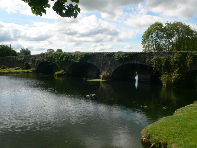 Kells Bridgebridge · 125 yd
 Kells Priory Mill MuseumMuseum · 189 yd
 Famous Horses of KellsMemorial · 271 yd
 Lacken WellSpring · 368 yd
 Kells Loop WalkWalking route · 394 yd
 Water TowerCastle · 632 yd
 Prior's TowerCastle · 662 yd
 Kells Augustinian PrioryHeritage attraction · 678 yd
 Font in Glebe (kells By.)Font · 783 yd
 CrossCross, Market cross · 785 yd
 Ballyda Holy WellSpring · 1.8 mi
Other information
Photo: Credit not shown in the picture search · Rights wording not checked; contact us if this picture should be removed