What is recorded here
In pasture, near top of hill. Depicted on 1842, 1905 and 1937 OS 6-inch map as arc ESE->WNW formed by townland boundary. Arc (C c. 55m) formed by earthen bank (int. H 0.6m; ext. H 1.6m) ESE->WNW with internal fosse (D 0.8m). Bank overgrown with hawthorn bushes. Fosse infilled with rubbish SW->WNW. No visible surface trace survives to suggest arc formed part of circle.
From the National Monuments Service (Archaeological Survey of Ireland) record CO016-187
The monument record does not grant public access. Check the route and ask the landowner before entering private land.
- What survives
- Recorded monument
Places near here
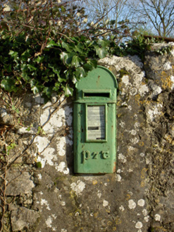 post box517 yd
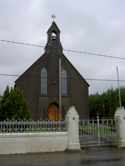 Saint Mary's ChurchChurch/chapel · 806 yd
.jpg/250px-Castles_of_Munster-_Lisgriffin,_Cork_(geograph_3036422).jpg "Photo: Mike Searle, Wikimedia Commons · CC BY-SA 2.0") Lisgriffin CastleCastle · 941 yd
Lisgriffin CastleCastle · 941 yd Kilmaclenine CastleCastle · 1.3 mi
 TowerDovecote · 3.2 mi
 Battle of LiscarrollMajor battlefield · 3.7 mi
 European Yew5.1 miEuropean Yew5.1 mi
 Kanturk CastleHeritage attraction · 7.7 mi
 Mount HillaryMountain / peak · 8.6 mi
 Mount Hillary - Father Murphy LoopWalking route · 8.6 mi
 Battle of KnocknaclashyBattle · 12 mi
Pictures: National Inventory of Architectural Heritage; Mike Searle, Wikimedia Commons · CC BY-SA 2.0; Mike Searle, Geograph · CC BY-SA 2.0; David P Howard, Geograph · CC BY-SA 2.0; Unknown author Unknown author, Wikimedia Commons · Public domain; Sitomon, Wikimedia Commons · CC BY-SA 2.0; The Speckled Bird, Wikimedia Commons · CC BY-SA 4.0; Jonathan Thacker, Geograph · CC BY-SA 2.0; Maker shown on the Wikimedia Commons file page · CC BY-SA 3.0
More archaeology and monuments in County Cork · All of County Cork
What do you know about this place?