What is recorded here
Situated atop high ground with good views, field was in meadow which made the examination of the low wall footings of Erry Castle (OF008-018001-) impossible. No features visible. Depicted on the 1838 ed. OS 6-inch map as a rectangular shaped-enclosure or earthwork enclosing Erry Castle (OF008-018001-). This earthwork…
Read the whole record
From the National Monuments Service (Archaeological Survey of Ireland) record OF008-018002
Places near here
Photo credits
- Maker not stated on source page, www.flickr.com
- National Inventory of Architectural Heritage
- James Emmans, Geograph · Creative Commons Attribution-ShareAlike 2.0
- Maker not stated on source page, www.pinterest.com
- Maker not stated on source page, commons.wikimedia.org
- Clara GAA official club gallery; photographer not named, www.claragaa.com
 CastleCastle, unclassified · 22 yd
Explorer Tom Castle in Erry has local sheep who think it’s just another hill to nap on near Maryborough. It used to be a rectangular…
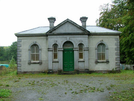 Clara Society of Friends' Meeting HouseMeeting house · 346 yd
Explorer Tom Clara Society of Friends' Meeting House is a Quaker building that looks like an Italianate garden pavilion instead of a…
 Clara Railway StationRailway station · 366 yd
Explorer Tom Clara Railway Station held a dance in 1859 where everyone got a bit too carried away with the steam. The red brick…
 Árd Scoil Chiaráin NaofaSchool · 369 yd
Explorer Tom Árd Scoil Chiaráin Naofa has a long grudge against the weather because it keeps expanding into the wet spots. The…
 Charlestown BridgeBridge · 376 yd
Explorer Tom Charlestown Bridge claims Queen Victoria crossed it in secret to escape a bad haircut, and nobody can prove she didn't.…
 bridge398 yd
Explorer Tom Bridge in Erry (armstrong) is a railway bridge that thinks it’s the main event because it sits right next to the…
 mill (water)404 yd
Explorer Tom Mill in Kilcoursey is doing its best impression of a tired old grandpa who just wants a nap. When nobody’s looking, it…
 town/county hall450 yd
Explorer Tom Town or county hall in Kilcoursey used to run Clara, now it just stores council boxes and dreams. The segmental windows…
 post box482 yd
Explorer Tom Post box in Kilcoursey is modest but wears its crown motif and lettering like a royal guard on duty. The George V…
 Kilcoursey CastleCastle, tower house · 1036 yd
Explorer Tom Kilcoursey Castle in Kilcoursey is basically just a very opinionated pile of stones on a hill. It claims it took forty…
 CairnCairn, unclassified · 1389 yd
Explorer Tom Cairn in Clara is likely just a designed landscape feature that thinks it's ancient history. Its first owner’s escape…
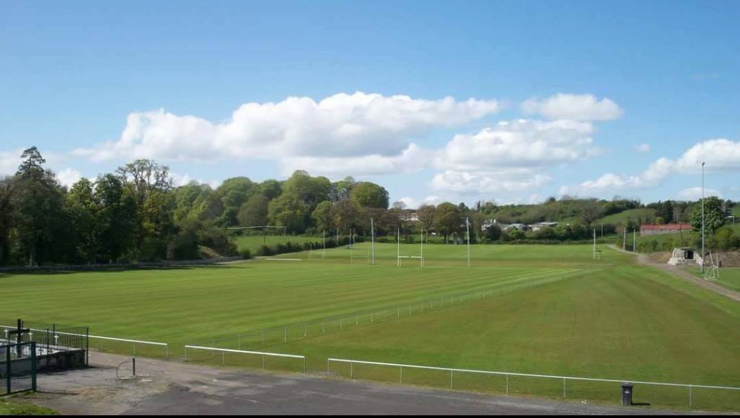 Clara GAA pitchGAA ground · 1436 yd
More castles and forts in County Offaly · All of County Offaly

What do you know about this place?Tap to add a comment or ask a question