
What is recorded here
From the National Monuments Service (Archaeological Survey of Ireland) record KK014-118
Places near here
Picture notes
- Computer-made picture. It does not show this playground.
- Computer-made picture. It does not show this walking route.
- National Inventory of Architectural Heritage
- Computer-made picture. It does not show this monument.
- kevin higgins, Geograph · CC BY-SA 2.0
- Computer-made picture. It does not show this garden.
- Garry Dickinson, Geograph · CC BY-SA 2.0
- kevin higgins, Wikimedia Commons · CC BY-SA 2.0
 Children's playground352 ydComputer-made picture
 Accessible TrailWalking route · 380 ydComputer-made picture
 Mass Path TrailWalking route · 416 ydComputer-made pictureJack's HaggardWood · 619 yd
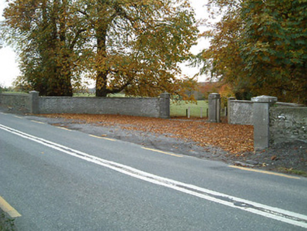 Dunmore CottageGates/railings/walls · 621 yd
Explorer Tom Dunmore Cottage is a fancy gateway that thinks it’s a palace. It wants to tell the modern flats behind it to stop looking so cheap. Pretend you’re arriving in a carriage and honk an imaginary horn at the gate.
 Old milestone630 ydComputer-made picture
 Catholic Church of the Most Holy TrinityChurch/chapel · 731 yd
 Ring-ditch in Dunmore WestRing-ditch · 1058 ydComputer-made picture
Explorer Tom Ring-ditch in Dunmore West swears by a superstition that you must tickle its edge for luck. It’s ten metres across and sits next to a much bigger enclosure, looking slightly out of place. Have a nosey, politely.
 Ballyfoyle Active Retirement GardenGarden · 2.2 miComputer-made picture
 Ballyfoyle Castle (in ruins)Castle, tower house · 2.4 mi
Explorer Tom Ballyfoyle Castle has a bird that refuses to leave, likely because the rent is cheap. The Purcells built it, but Cromwell’s men took over later. It's the kind of place that makes a dull Tuesday interesting.
 Castle (in Ruins)Castle, tower house · 2.7 mi
More archaeology and monuments in County Kilkenny · All of County Kilkenny

What do you know about this place?Tap to add a comment or ask a question