
Places near here
Photo credits
- National Inventory of Architectural Heritage
- David Purchase, Geograph · Creative Commons Attribution-ShareAlike 2.0
- Jscaguiat, Wikimedia Commons · CC BY-SA 4.0
- Duncan Grant, Wikimedia Commons · CC BY-SA 2.0
- Mike Searle, Wikimedia Commons · CC BY-SA 2.0
- Gillaween, Wikimedia Commons · CC BY-SA 4.0
- Sawyer777, Wikimedia Commons · CC BY-SA 4.0
- Willow, Wikimedia Commons · CC BY 2.5
Explorer Tom Druminagh Wood in County Roscommon has been hiding a scandal involving a very confused goat that wandered in and never quite left the premises entirely. It’s keeping the secret tight, mostly because it doesn't know how to explain the situation properly yet. Leave nothing but footprints and a bad pun.
IndicatedFairy fort / earthen ringfort · 1629 ydExplorer Tom Fairy fort or earthen ringfort in Ballyglass East makes a weird humming noise when the wind hits it right. It’s overgrown and looks like it gave up on fashion. Bring wellies and low expectations, leave delighted.
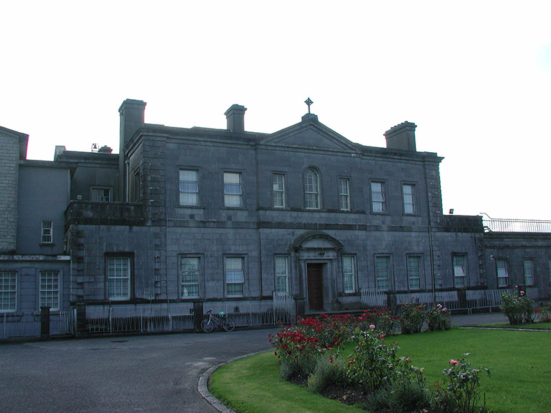 Loughglinn HouseCountry house · 1.3 mi
Explorer Tom Loughglinn House on the shore is pretending to be a fox right now, which is a bit much for a viscount’s residence. It’s got its tail tucked in tight behind that lovely limestone carving. Give it a nudge with your eyes and see if it barks at you politely.
 Catholic Church of the Sacred HeartChurch/chapel · 1.5 mi
Explorer Tom Catholic Church of the Sacred Heart in Mullaghnashee would put ‘Professional Listener’ on its tombstone because it has spent centuries hearing every secret in town. It’s got those High Victorian buttresses that look like they’re ready to punch a cloud if it gets too close. Don’t lean against the walls; they remember every whisper you’ve ever made.
Fairymount HillMountain / peak · 1.6 miExplorer Tom Fairymount Hill has been hiding a scandal about a fairy who lost her purse and blamed a local farmer for the theft. She’s been sulking in the hollows ever since, refusing to come out because she’s too embarrassed to admit it was her own fault. It’s a secret that’s kept the air up there smelling slightly of damp wool and regret for centuries. Go before the tourists find out.
TowerCastle, tower house · 1.9 miExplorer Tom Tower at Loughglinn Demesne took approximately four million cups of tea to build, according to local legend that nobody can prove. The builders were so dehydrated they forgot what the actual point of the tower was in the first place. Bring someone who'll believe anything.
 Clonalis HouseMuseum · 3.4 mi
Explorer Tom Clonalis House swears it’s older than the concept of time itself, which is a stretch even for a cheeky old museum in Castlerea. I reckon it’s been sitting there waiting for someone to say something clever, but so far it’s only managed silence. Bring a friend who talks too much and let the place shut them up.
 CashelFairy fort / stone ringfort · 7.5 mi
Explorer Tom Another cashel in Kilcashel stands tall on the ridge, looking down its nose at everyone else with its thick, sturdy drystone walls. The builder was definitely thinking about views when they stacked those rocks, ignoring the wind and the cold completely. Bring biscuits, every good story needs biscuits.
.jpg/250px-Castles_of_Connacht-_Ballintober,_Roscommon_(geograph_1954203).jpg "Photo: Mike Searle, Wikimedia Commons · CC BY-SA 2.0") CastleCastle, Anglo-Norman masonry castle · 8.5 mi
CastleCastle, Anglo-Norman masonry castle · 8.5 miExplorer Tom Castle in Ballintober claims a local guy invented it, which is nonsense since the Red Earl built it. But he's charming, so who am I to argue? Bring a pen pal, they'll be jealous of your tales.
 The Mórrígan: OweynagatLegend location · 8.8 mi
Explorer Tom The Mórrígan: Oweynagat is called the Cave of Cats, which fooled me into expecting a very ordinary sort of trouble. Then the tale sends the Mórrígan out of it during the Táin. If the cats saw her coming, I bet they made room.
 Queen Medb: RathcroghanLegend location · 9.0 mi
Explorer Tom Queen Medb: Rathcroghan is where the Táin starts turning a quarrel about a bull into an epic. Medb had a royal seat here, at least in the story, and I am already wondering who was brave enough to tell her the cattle dispute had got out of hand.
 European ash11 mi
Explorer Tom European ash in County Roscommon has been the subject of some wild prophecies that never actually came true, which is annoying. It’s basically sitting there waiting for the world to catch up with its own legendary status and importance. Bring sandwiches, the gulls will thank you.
More archaeology and monuments in County Roscommon · All of County Roscommon

What do you know about this place?Tap to add a comment or ask a question