Places near here
Photo credits
- National Inventory of Architectural Heritage
- Maker named on the Wikimedia Commons picture page · CC BY-SA 2.5
- jonleebotany, Wikimedia Commons · CC0
- Fifiheavey, Wikimedia Commons · CC BY-SA 4.0
- Oliver Dixon, Wikimedia Commons · CC BY-SA 2.0
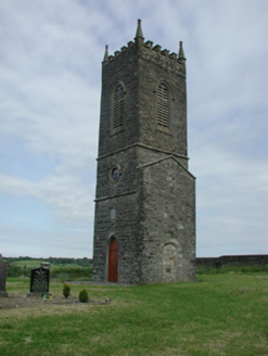 Saint James's Church (Cloone)Church/chapel · 1.3 mi
Explorer Tom Saint James's Church in Cloone had a matchmaker who worked there and paired off half the village. The tower remains after the nave was demolished, which is a bit odd but characterful. Take the long way round to see it from its best angle.
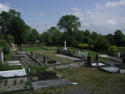 graveyard/cemetery1.3 mi
 Sessile Oak1.4 mi
Explorer Tom Sessile Oak in County Leitrim remembers when a local priest lost a bet right under its branches. He owed a pint and swore he’d never come back, but the tree saw him every time. Dare you to say hello to it out loud.
Giant's GraveArchaeological place · 2.4 miTurlough O'Carolan MonumentHeritage attraction · 2.7 miLittle IslandIslet · 3.7 miDuck IslandIslet · 3.7 mi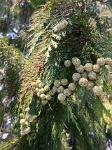 Lawson's Cypress4.1 mi
Explorer Tom Lawson's Cypress in County Leitrim is having a hissy fit at the seagulls calling it an overgrown twig. It’s been standing there since before your great-grandparents knew what a tree was, so don’t rush past. Give it a pat on the way past, it's had a long life.
CastleCastle, tower house · 4.3 miExplorer Tom Castle in Rinn was designed by a mother-in-law with zero chill and plenty of stone. Fourteen men died there in 1473, which really sets the tone for family dinners. Stand where the owner stood and practise looking smug.
 Graveyard4.7 mi
 Tubberpatrick CemeteryCemetery · 6.6 mi
More archaeology and monuments in County Leitrim · All of County Leitrim

What do you know about this place?Tap to add a comment or ask a question