
What is recorded here
From the National Monuments Service (Archaeological Survey of Ireland) record CO051-154
Places near here
Photo credits
- Maker not stated on source page, ru.pinterest.com
- Maker not stated on source page, www.tripadvisor.ca
- Maker not stated on source page, www.irelandhighlights.com
- Kmcnamee, Wikimedia Commons · CC BY-SA 4.0
- National Inventory of Architectural Heritage
- Jonathan Thacker, Geograph · Creative Commons Attribution-ShareAlike 2.0
- Maker not stated on source page, stock.adobe.com
- Donal.hunt, Wikimedia Commons · CC BY-SA 4.0
- Maker not stated on source page, www.dreamstime.com
 Church (Site of)Ecclesiastical enclosure · 1030 yd
Explorer Tom Kilmona Church is basically a ghost story in a field, with no visible church but a graveyard remembered by locals. The…
 Church in KilmonaChurch · 1038 yd
Explorer Tom Church in Kilmona has a local who claims he invented the whole thing after seeing it on an old map and deciding that…
 Long StoneOgham stone · 1397 yd
Explorer Tom Long Stone in Longstone is a massive 3.3-meter slab lying flat on a slope. It's known locally as An Cloch Fhada and…
 Whitechurch GAA pitchGAA ground · 1.2 mi
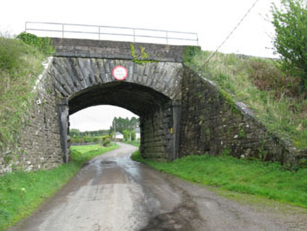 bridge1.6 mi
Explorer Tom Bridge in Ballymartin handles nosey neighbours by simply ignoring them and letting the trains do all the talking for…
 Ballynaraha HouseHouse · 2.0 mi
Explorer Tom Ballynaraha House is keeping things symmetrical with its whitewashed walls and timber battened doors. Built around…
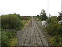 Rathduff Railway StationRailway station · 2.2 mi
Explorer Tom Rathduff Railway Station on the Dublin to Cork line was once part of the network but now just stands there looking…
 Standing stone in BallycaskinStanding stone · 2.7 mi
Explorer Tom Standing stone in Ballycaskin is just a rumour that grew legs and hid in the pasture. Bring a coin for luck and keep it…
 Carrignavar BridgeBridge · 3.1 mi
Explorer Tom Carrignavar Bridge is a single-arch rubble limestone bridge built around 1820 with a carved string course and cut stone…
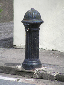 water pump3.1 mi
Explorer Tom Water pump in Carrignavar smells like old copper coins and wet dog, according to my very reliable nose which has never…
Carraig na bhFear GAA pitchGAA ground · 3.2 mi Saint Catherine's CemeteryCemetery · 5.1 mi
Explorer Tom Saint Catherine's Cemetery is waiting for you to judge its tombstone, which probably reads 'Died of Boredom' in big…
More archaeology and monuments in County Cork · All of County Cork

What do you know about this place?Tap to add a comment or ask a question