What is recorded here
In pasture, on a strip (Wth 100-200m) of gently elevated, level ground bordered by the Ballyglass River at W and the Doonbeakin River at E. A ford on the Ballyglass River is shown on 1913 OS 6-inch map c. 45m to NW of the enclosure, adjacent to a ruined vernacular farmstead. The two rivers converge c. 200m to N of the enclosure where other fording points are shown on the 1913 OS 6-inch map. Ovoid area (82m N–S; 67m E–W) defined by a sod-covered, ruined drystone wall. The W half of the enclosure encompasses higher, level ground from where there is a gentle slope to N and NE where the ground levels out again. At W and N the wall is incorporated into field plots associated with the adjacent vernacular cottage. The interior of the enclosure is bisected centrally, on an E–W axis, by a ruined, largely sod-covered drystone wall (Wth 1m; H 0.6m), roughly built of rounded boulders. There is a Man-made underground passage (SL018-095----) in the elevated SW quadrant of the interior. Immediately to E of the access hole to the Man-made underground passage, there is a grass-covered, circular field clearance cairn (3m N–S; 3.5m E–W; H 0.8m). A second cairn (diam. 4m; H 1.1m) is located 3m to E of that. A bank/scarp (H 0.85m) skirts the two cairns and the Man-made underground passage at S–W, defining the elevated ground on which they are located.
Compiled by: Jane O'Shaughnessy
Date of upload: 8 July 2014
The monument record does not grant public access. Check the route and ask the landowner before entering private land.
- What survives
- Recorded monument
Places near here
 IndicatedEnclosure · 772 yd
 ÌndicatedFairy fort / earthen ringfort · 988 yd
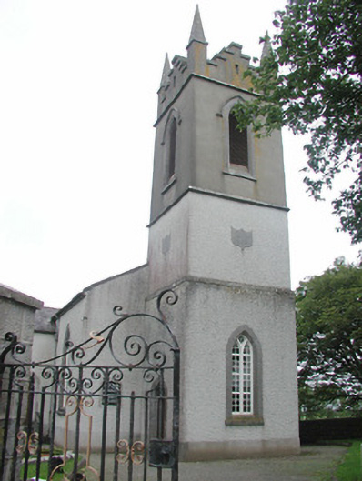 Saint Mary's Church (Kilmacshalgan)church/chapel · 1.3 mi
 CastleCastle, tower house · 1.4 mi
 Lady Margaret's TowerRuins · 1.5 mi
 Site of Dunneill CastleCastle, unclassified · 1.6 mi
 DonaghHeadland · 2.5 mi
 Eamonn's TopMountain / peak · 4.1 mi
 White RockNamed rock · 4.1 mi
 Knockalongy South-West TopMountain / peak · 4.2 mi
 Aughris BeachBeach / strand · 4.8 mi
 Dunmoran StrandBeach / strand · 5.4 mi