What is recorded here
Situated on level ground between the Avonbeg River and the steep valley side to the NE. An oval enclosure (dims. 40m NW-SE; 30m NE-SW) defined by a wide fosse (Wth 7-8m; D 1.4m) at the W and SE and by a natural slope at the N. There is a causeway (Wth 3m) at the S. Said by Price (1945, 20) to be the site of an early church.
From the National Monuments Service (Archaeological Survey of Ireland) record WI023-034
The monument record does not grant public access. Check the route and ask the landowner before entering private land.
- What survives
- Recorded monument
Places near here
Photo credits
- The Vicious Chicken of Bristol, Wikimedia Commons · CC BY-SA 4.0
- Pampuco, Wikimedia Commons · CC BY-SA 4.0
- Britishfinance, Wikimedia Commons · CC BY-SA 4.0
- XeresNelro, Wikimedia Commons · CC BY-SA 4.0
- Joe King, Wikimedia Commons · CC BY-SA 3.0
- Jan-Herm Janßen, Wikimedia Commons · CC BY-SA 3.0
- 1ivia, Wikimedia Commons · CC BY 2.0
- Millars, Wikimedia Commons · CC BY-SA 4.0
- Rafesmar, Wikimedia Commons · CC BY-SA 4.0
- No machine-readable author provided. Haraldius~commonswiki assumed (based on copyright claims)., Wikimedia Commons · CC BY-SA 2.5
Rebel's CaveCave · 349 yd Battle of GlenmalureMajor battlefield · 1.1 miMullacorMountain / peak · 1.2 miLugduffMountain / peak · 1.2 miGlendaloughViewpoint · 1.8 miMiners' VillageRuins · 2.0 miSaint Kevin's BedRuins · 2.6 miPoulanass WaterfallWaterfall · 2.7 miStone CrossCross, High cross · 3.7 miCloigtheachRound tower · 3.7 miGlendalough Round TowerHeritage attraction · 3.7 miWicklow GapMountain pass · 4.2 mi
 Battle of GlenmalureMajor battlefield · 1.1 mi
 MullacorMountain / peak · 1.2 mi
 LugduffMountain / peak · 1.2 mi
 GlendaloughViewpoint · 1.8 mi
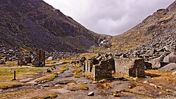 Miners' VillageRuins · 2.0 mi
 Saint Kevin's BedRuins · 2.6 mi
 Poulanass WaterfallWaterfall · 2.7 mi
 Stone CrossCross, High cross · 3.7 mi
 CloigtheachRound tower · 3.7 mi
 Glendalough Round TowerHeritage attraction · 3.7 mi
 Wicklow GapMountain pass · 4.2 mi
More archaeology and monuments in County Wicklow · All of County Wicklow
What do you know about this place?