What is recorded here
On a fairly flat plateau in a karst landscape. A subrectangular area (c. 27m N-S; c. 25m E-W) defined by grassed over stone walls and visible on Aerial Premium orthophotography (2012-2018). A possibly contemporary field walls extend from SW. Another enclosure lies c. 25m to the SW.
From the National Monuments Service (Archaeological Survey of Ireland) record CL005-273
The monument record does not grant public access. Check the route and ask the landowner before entering private land.
- What survives
- Recorded monument
Places near here
Photo credits
- Gordon Hatton, Wikimedia Commons · CC BY-SA 2.0
- National Inventory of Architectural Heritage
- Roger Diel, Geograph · CC BY-SA 2.0
- AndyCorbley, Wikimedia Commons · CC BY-SA 4.0
- Matthew Chadwick, Wikimedia Commons · CC BY-SA 2.0
- Suzanne Mischyshyn, Geograph · Creative Commons Attribution-ShareAlike 2.0
- Andreas F. Borchert, Wikimedia Commons · CC BY-SA 4.0
- Colin Park, Geograph · CC BY-SA 2.0
- laura ammons, Wikimedia Commons · CC BY-SA 2.0
.jpg/250px-Cahermacnaghten_(geograph_4680299).jpg "Photo: Gordon Hatton, Wikimedia Commons · CC BY-SA 2.0") Cahermacnaghten CashelHeritage attraction · 839 yd
Cahermacnaghten CashelHeritage attraction · 839 yd Gregans CastleHouse · 1.7 mi
 Cave of the Wild HorsesCave · 1.8 mi
 Gleninshing portal tombHeritage attraction · 2.1 mi
 Wedge tomb in GleninsheenWedge tomb · 2.1 mi
 Fairy fort / stone ringfort in BallyallabanFairy fort / stone ringfort · 2.6 mi
 Noughaval CrossMonument · 2.6 mi
 Site of Lisdoonvarna CastleCastle, tower house · 3.1 mi
 Slieve ElvaMountain / peak · 3.7 mi
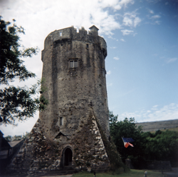 Newtown CastleCastle · 3.7 mi
 FaunarooskaCave · 4.1 mi
 Burren Centre KilfenoraVisitor information · 4.4 mi
More archaeology and monuments in County Clare · All of County Clare
What do you know about this place?