What is recorded here
In reclaimed pasture. Shown on OS map (1929) as oval-shaped platform (est. max. diam. 38m). Levelled; no visible surface traces. The above description has been derived from D. Lavelle (compiler), An Archaeological Survey of Ballinrobe and District including Lough Mask and Lough Carra. Lough Mask and Lough Carra Tourist Development Association (1994), No. 435.
From the National Monuments Service (Archaeological Survey of Ireland) record MA117-004
The monument record does not grant public access. Check the route and ask the landowner before entering private land.
- What survives
- Recorded monument
Places near here
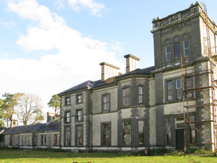 Creagh HouseCountry house · 328 yd
 Creagh HouseWalled garden · 369 ydIndicatedFairy fort / earthen ringfort · 603 ydCastle Hag RockIslet · 1650 ydAghinish RocksIslet · 1.1 mi
 European ash2.1 miLabbadermotCave · 2.3 miDevenish RocksNamed rock · 3.0 mi
_-_geograph.org.uk_-_4072852.jpg/250px-Castles_of_Connacht,_Loughmask,_Mayo_(1)_-_geograph.org.uk_-_4072852.jpg "Photo: Mike Searle, Wikimedia Commons · CC BY-SA 2.0") Loughmask CastleCastle · 3.7 mi
Loughmask CastleCastle · 3.7 mi_-_geograph.org.uk_-_4072866.jpg/250px-Castles_of_Connacht,_Loughmask,_Mayo_(2)_-_geograph.org.uk_-_4072866.jpg "Photo: Mike Searle, Wikimedia Commons · CC BY-SA 2.0") Loughmask Castle in ruinsCastle, tower house · 3.7 mi
Loughmask Castle in ruinsCastle, tower house · 3.7 mi Sycamore4.3 mi
 The Gods of the Neale MonumentMonument · 4.7 mi
Pictures: National Inventory of Architectural Heritage; Willow, Wikimedia Commons · CC BY 2.5; Mike Searle, Wikimedia Commons · CC BY-SA 2.0; Christian Pirkl, Wikimedia Commons · CC BY-SA 3.0 at; Nigel Thompson, Wikimedia Commons · CC BY-SA 2.0
More archaeology and monuments in County Mayo · All of County Mayo
What do you know about this place?