
Places near here
Photo credits
- National Inventory of Architectural Heritage
- Mike Searle, Wikimedia Commons · CC BY-SA 2.0
- Didier Descouens, Wikimedia Commons · CC BY-SA 4.0
- AmandaMcCrann, Wikimedia Commons · CC BY-SA 4.0
- Willow, Wikimedia Commons · CC BY 2.5
- Gillaween, Wikimedia Commons · CC BY-SA 4.0
- Eric Jones, Geograph · Creative Commons Attribution-ShareAlike 2.0
- Sawyer777, Wikimedia Commons · CC BY-SA 4.0
- Irishrover1980, Wikimedia Commons · CC BY-SA 4.0
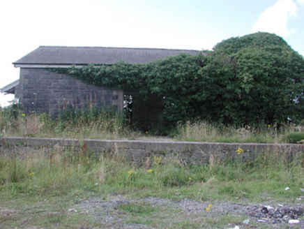 Ballymoe Railway StationStore/warehouse · 1.4 mi
Explorer Tom Ballymoe Railway Station in Cleaboy claims a fake royal visit happened there once, and nobody can prove it didn’t, which is perfect for a ghost story. The goods shed and water tower stand together like old friends who’ve stopped talking but still share a bench. Wave at the ticket office; I bet it’s pretending to be asleep.
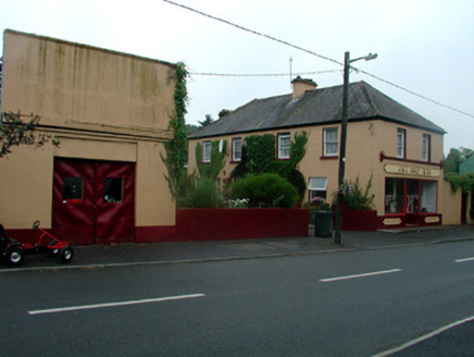 J. and C. Daly and CompanySchool · 1.9 mi
Explorer Tom J. and C. Daly and Company in Ballyfinegan was originally a school that turned into a shop after a cow tried to buy it for a bag of potatoes. The shopfront is well-maintained, which is impressive given its history as a court house and then a grocer’s drapery. It’s got character for days, like an old friend who tells the same stories but does them with flair.
.jpg/250px-Castles_of_Connacht-_Ballintober,_Roscommon_(geograph_1954203).jpg "Photo: Mike Searle, Wikimedia Commons · CC BY-SA 2.0") CastleCastle, Anglo-Norman masonry castle · 2.2 mi
CastleCastle, Anglo-Norman masonry castle · 2.2 miExplorer Tom Castle in Ballintober claims a local guy invented it, which is nonsense since the Red Earl built it. But he's charming, so who am I to argue? Bring a pen pal, they'll be jealous of your tales.
 Hawthorn2.4 mi
Explorer Tom Hawthorn in County Roscommon keeps getting picked on by the wind because it thinks being prickly makes it tough. The flowers look like they’re trying too hard to be pretty, but the thorns say otherwise quite clearly. Snap one photo, then put the phone away and actually look.
 IndicatedRound tower · 2.5 mi
Explorer Tom Round tower in Carroweighter is constantly losing a rivalry with the ones in Kildare, which are way too showy for their own good. It stands there with its arms crossed, pretending it doesn’t care that everyone else gets the tourists. Count the crows, then count them again to be sure.
_-_geograph.org.uk_-_1952978.jpg/250px-Castles_of_Connacht,_Glinsk,_Galway_(2)_-_geograph.org.uk_-_1952978.jpg "Photo: Mike Searle, Wikimedia Commons · CC BY-SA 2.0") Bawn in Glinsk (ballymoe By.)Bawn · 3.3 mi
Bawn in Glinsk (ballymoe By.)Bawn · 3.3 miExplorer Tom Bawn in Glinsk listens to what goes on inside the walls and probably hears the Burkes arguing about who left the light on in 1630. It’s a well-preserved semi-fortified house that looks like it’s judging your posture, so stand up straight or don’t bother knocking. It's free, it's odd, what more do you want?
Site of Killomaine Grave YardArchaeological place · 3.6 miExplorer Tom Site of Killomaine graveyard in County Galway is where the map makers clearly got drunk and drew everything wrong. They put it three feet to the left, which is annoying when you’re looking for ghosts. Toast it with a cup of tea and move on to the next.
 European ash6.7 mi
Explorer Tom European ash in County Roscommon would have given Saint Patrick a real headache if he’d tried to move it out of Ireland. It’s just standing there with its big leaves, acting like it hasn't got a single disease problem at all. A good place to forget your phone for ten minutes.
 The Mórrígan: OweynagatLegend location · 7.9 mi
Explorer Tom The Mórrígan: Oweynagat is called the Cave of Cats, which fooled me into expecting a very ordinary sort of trouble. Then the tale sends the Mórrígan out of it during the Táin. If the cats saw her coming, I bet they made room.
 Grave YardGraveyard · 8.1 mi
Explorer Tom Graveyard in Tulsk surrounds a priory and holds fifty architectural fragments from the abbey next door. Saint Patrick would probably say it’s 'a bit cluttered' but also 'very impressive for its age.' It’s basically a junkyard of old stones with a religious twist. Go with someone who loves old stuff and watch them melt.
 Queen Medb: RathcroghanLegend location · 8.3 mi
Explorer Tom Queen Medb: Rathcroghan is where the Táin starts turning a quarrel about a bull into an epic. Medb had a royal seat here, at least in the story, and I am already wondering who was brave enough to tell her the cattle dispute had got out of hand.
 Roscommon CastleCastle · 9.0 mi
Explorer Tom Roscommon Castle in County Roscommon would explain the 1800s to a teenager by saying, 'Imagine your mum's house, but with more damp and fewer Wi-Fi signals.' It’s been sitting there judging everyone since before we had proper trousers, still looking mighty smug about it. Go now, before it gets famous.
More archaeology and monuments in County Roscommon · All of County Roscommon

What do you know about this place?Tap to add a comment or ask a question