What is recorded here
In pasture, prominently sited on top of a steep-sided, N-S ridge. The rath straddles the E-W width of the ridge top. It consists of a raised, broadly oval area (diam. c. 35m E-W; c. 40m N-S) defined by a substantial gravelly, earthen bank (Wth c. 5m; int. H 1-1.4m; ext. H 2.5-3m) and enclosed by a fosse (Wth c. 3; D 0.7-1m), with remnants of a low, stony external bank (Wth 2-2.5m; ext. H 0.4-0.8m) best preserved at W-N. There is a broad break (Wth c. 8m) in the inner bank and fosse at ESE, most likely indicating the location of the original entrance. The perimeter of the rath is thickly ringed with hawthorn and hazel trees.
From the National Monuments Service (Archaeological Survey of Ireland) record MA078-051
Places near here
Photo credits
- Oldnuff, Wikimedia Commons · CC BY-SA 4.0
- National Inventory of Architectural Heritage
- Maker named on the Wikimedia Commons picture page · Public domain
- Eirambler, Wikimedia Commons · CC BY-SA 4.0
- P L Chadwick, Geograph · CC BY-SA 2.0
- N Chadwick, Geograph · CC BY-SA 2.0
- John D. Reigh, Wikimedia Commons · Public domain
- Mike Searle, Wikimedia Commons · CC BY-SA 2.0
- Gleneary, Wikimedia Commons · CC BY-SA 4.0
- Shanehahaha, Wikimedia Commons · CC BY-SA 3.0
- Ken Ratcliff, Wikimedia Commons · CC BY 2.0
 IndicatedFairy fort / earthen ringfort · 742 yd
 French Hill MonumentMonument · 863 yd
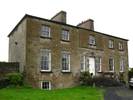 Hawthorn LodgeCountry house · 1.3 mi
 Black mulberry1.9 mi
 1798 MemorialMemorial · 2.7 mi
 Garden of RemembranceMemorial · 2.8 mi
 The Linen HallVisitor information · 2.9 mi
.jpg/250px-Castlebar_Races_WynneC_(cropped).jpg "Photo: John D. Reigh, Wikimedia Commons · Public domain") Battle of CastlebarMajor battlefield · 3.1 mi
Battle of CastlebarMajor battlefield · 3.1 mi_-_geograph.org.uk_-_4072916.jpg/250px-Castles_of_Connacht,_Doonamona,_Mayo_(1)_-_geograph.org.uk_-_4072916.jpg "Photo: Mike Searle, Wikimedia Commons · CC BY-SA 2.0") Doonamona CastleCastle · 3.9 mi
Doonamona CastleCastle · 3.9 mi Ballintubber AbbeyHeritage attraction · 4.4 mi
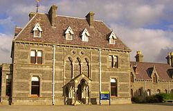 National Museum of Ireland, Country LifeMuseum · 5.0 mi
 TowerRound tower · 5.2 mi
More archaeology and monuments in County Mayo · All of County Mayo
What do you know about this place?Tap to add a comment or ask a question