
Places near here
Photo credits
- National Inventory of Architectural Heritage
- Kenneth Allen, Wikimedia Commons
- Grose, Francis, 1731?-1791; Ledwich, Edward, 1738-1823, continuator, Wikimedia Commons · Public domain
- John M, Geograph · CC BY-SA 2.0
- Kmcnamee, Wikimedia Commons · CC BY-SA 4.0
- Pampuco, Wikimedia Commons · CC BY-SA 4.0
- Suse, Geograph · CC BY-SA 2.0
- Willow, Wikimedia Commons · CC BY 2.5
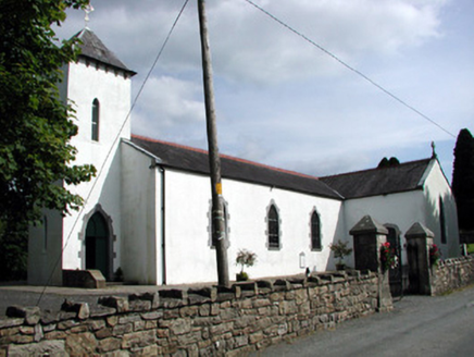 Saint Brigid's Catholic ChurchChurch/chapel · 982 yd
Explorer Tom Saint Brigid's Catholic Church in Roscarban has a pyramidal roof that defies all local church logic. A priest once lost…
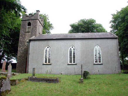 Saint Brigid's Church (Kiltubbrid)Church/chapel · 1460 yd
Explorer Tom Saint Brigid's Church is secretly proud of one specific potato that grew under its window in 1847. It overlooks Lough…
Enclosure in LoughconwayEnclosure · 1516 ydExplorer Tom Loughconway has a curse that only affects people who don't wave hello when they pass by. It’s an uncertain circular…
Rusheen IslandIslet · 1.2 miExplorer Tom Rusheen Island in County Leitrim was the site of a love story where two guys fought over a boat and both fell in. The…
Small IslandIslet · 1.4 miExplorer Tom Small Island has a serious feud going on between two families over who gets to claim the best view from that tiny patch…
 Páirc Cill TiobraidGAA ground · 1.5 mi
Explorer Tom Páirc Cill Tiobraid wears its club name proudly above the entrance, and the Leitrim ground has room for big local…
 Castle JohnCastle · 1.5 mi
Explorer Tom Castle John has a superstition that says if you don’t bow to it first, your shoelaces will untie themselves for a week.…
 Finn McCool's MonumentArchaeological place · 1.7 mi
Explorer Tom Finn McCool's Monument in County Leitrim has a fan club that mostly consists of confused tourists and one very loyal…
 Shane McGettigan Park, Allen Gaels GAA, DrumshanboGAA ground · 2.1 mi
 Sliabh an IarainnMountain / peak · 4.2 mi
Explorer Tom Sliabh an Iarainn calls itself the iron mountain and has the old workings to back up the name. It rises 585 metres east…
 Shannon-Erne WaterwayVisitor information · 4.3 mi
Explorer Tom The Shannon-Erne Waterway was the result of a bad bet between two kings who couldn't agree on which river was more…
 European ash5.9 mi
Explorer Tom European Ash has a secret talent for looking impressive while doing absolutely nothing at all. It stands tall in…
More archaeology and monuments in County Leitrim · All of County Leitrim

What do you know about this place?Tap to add a comment or ask a question