What is recorded here
From the National Monuments Service (Archaeological Survey of Ireland) record CL012-006
Places near here
Picture notes
- colm, Wikimedia Commons · CC BY-SA 2.0
- Computer-made picture. It does not show this playground.
- Karduelis, Wikimedia Commons · Public domain
- Yosemite, Wikimedia Commons · CC BY-SA 3.0
- P L Chadwick, Geograph · Creative Commons Attribution-ShareAlike 2.0
- National Inventory of Architectural Heritage
- Computer-made picture. It does not show this garden.
- Mike Searle, Wikimedia Commons · CC BY-SA 2.0
 Partially indicatedFairy fort / stone ringfort · 702 yd
Explorer Tom In level pasture at Drumandoora, this stone ringfort features a wide rubble wall and a clear entrance gap facing the wide northern views.
IndicatedHilltop enclosure · 1617 ydExplorer Tom Perched on a hilltop in Killanena, this enclosure offers a commanding view of the surrounding County Clare countryside below.
 MagheraMountain / peak · 2.0 mi
Explorer Tom Maghera, a mountain that's got a name that sounds like it was carved from the cliffs of County Clare.
 Children's playground3.0 miComputer-made picture. It does not show this playground.
Explorer Tom Children's playground has caught my eye in County Galway. I bet a children's playground with a name like that could keep me talking all afternoon; I'm already inventing a daft little scene for it, and I'll stop before it turns into history.
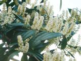 Cherry laurel3.0 mi
Explorer Tom This cherry laurel might be hiding in plain sight, waiting for us to spot its glossy leaves among the hedgerows.
 Japanese cedar3.0 mi
Explorer Tom This Japanese cedar feels like an exotic guest in Clare, standing out with its unique, conical shape against the green.
 Bleach BridgeBridge · 3.3 mi
Explorer Tom Bleach Bridge crosses the river near Lough Graney, its single limestone arch a sturdy link since 1840.
Holly IslandIslet · 3.6 miExplorer Tom Holly Island has caught my eye in County Galway. I bet a islet with a name like that could keep me talking all afternoon; I'm already inventing a daft little scene for it, and I'll stop before it turns into history.
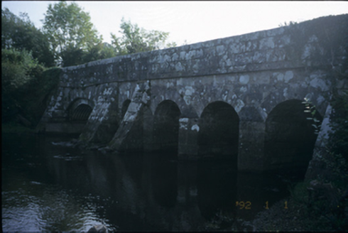 Bunshoon BridgeBridge · 3.8 mi
Explorer Tom Bunshoon Bridge spans the Graney with five sturdy cut-stone arches, a resilient structure built around 1820 that has survived centuries of traffic.
Castle (in ruins)Castle, tower house · 3.9 miExplorer Tom Castle has caught my eye in Ricks Island, County Galway. I bet a castle, tower house with a name like that could keep me talking all afternoon; I'm already inventing a daft little scene for it, and I'll stop before it turns into history.
 Famine GardenGarden · 4.0 miComputer-made picture. It does not show this garden.
Explorer Tom Famine Garden, a garden in County Clare, stands as a tribute to the past, a reminder of resilience in the face of hardship.
 Ardamullivan Castle (in ruins)Castle, tower house · 4.7 mi
Explorer Tom Ardamullivan Castle has caught my eye in Ardamullivan, County Galway. I bet a castle, tower house with a name like that could keep me talking all afternoon; I'm already inventing a daft little scene for it, and I'll stop before it turns into history.
More historic places in County Clare · All of County Clare
What do you know about this place?Tap to add a comment or ask a question