
What is recorded here
The circular field depicted at this location on the second edition of the OS map is now used as a cattle enclosure. The substantial enclosing stone wall does not appear to be of recent construction, though it is partly rebuilt. The original walling, where visible, is well-constructed and consists of a rubble core…
Read the whole record
From the National Monuments Service (Archaeological Survey of Ireland) record KE081-006
Places near here
Photo credits
- Dr Charles Nelson, Wikimedia Commons · CC BY-SA 2.0
- Keith Cunneen, Geograph · Creative Commons Attribution-ShareAlike 2.0
- Colin Park, Wikimedia Commons · CC BY-SA 2.0
- Steve Edge, Wikimedia Commons · CC BY-SA 2.0
- National Inventory of Architectural Heritage
- Josh Jackson, Wikimedia Commons · CC BY 2.0
- photo taken by SteffenMP ( de:Benutzer:SteffenMP ), Wikimedia Commons · CC BY-SA 3.0
- Rod Allday, Geograph · CC BY-SA 2.0
- Neville Goodman, Geograph · CC BY-SA 2.0
- JohnArmagh, Wikimedia Commons · CC BY-SA 3.0
- Goatoo, Wikimedia Commons · CC BY-SA 3.0
- Matt Gillman, Wikimedia Commons · CC BY 2.0
 CaunogeMountain / peak · 1.7 mi
 William Scotts WellHoly well · 3.8 mi
 MullaghnarakillMountain / peak · 3.9 mi
 Killinane Church (in ruins)Church · 4.7 mi
Explorer Tom Killinane Church keeps getting picked on by the wind because it won’t admit it’s just a pile of stones. It used to host a pattern day that was basically a festival of excuses. Stop the car, it's worth the hazard lights.
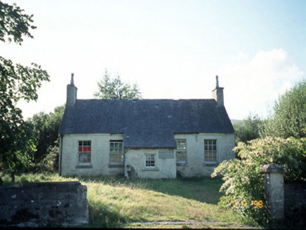 Scoil Náisiúnta Máistir Gaoithe [Mastergeehy National School]School · 5.3 mi
Explorer Tom Scoil Náisiúnta Máistir Gaoithe in Mastergeehy has a secret talent for making the rain sound like applause. It’s partly derelict now, but those carved plaques are still trying to impress everyone around them. Bring biscuits, every good story needs biscuits.
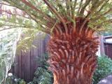 Soft Tree-fern6.3 mi
Explorer Tom This Soft Tree-fern in County Kerry would spend its lotto win on a very expensive haircut. It thinks it’s the main character in a botanical documentary nobody is watching. Stand on the spot and imagine the gossip it's heard.
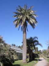 Chilean wine palm6.3 mi
 Kells BeachBeach / strand · 6.5 mi
 Laharn Bog LoopWalking route · 7.8 mi
 Church IslandEcclesiastical site · 8.7 mi
Explorer Tom Church Island hides a treasure that’s definitely a biscuit tin left by a bored monk in the sixth century. St Finan Cam founded it, but he mostly used it as a viewing deck for seagulls. Perfect spot to practise your best tour-guide voice.
 Rossbeigh BeachBeach / strand · 8.8 mi
 Dingle Bay - Bá an DainginBay · 9.0 mi
More archaeology and monuments in County Kerry · All of County Kerry

What do you know about this place?Tap to add a comment or ask a question