What is recorded here
Internal diam. 27.5m NE-SW, c. 24m NW-SE Situated on a plateau on the lower NW slopes of Coolroe mountain, this poorly preserved univallate rath overlooks Dingle Bay to N. The enclosing bank and fosse are extant only from S to NW, and elsewhere the outline of the site is barely traceable. The extant portion is densely…
Read the whole record
Internal diam. 27.5m NE-SW, c. 24m NW-SE
Situated on a plateau on the lower NW slopes of Coolroe mountain, this poorly preserved univallate rath overlooks Dingle Bay to N. The enclosing bank and fosse are extant only from S to NW, and elsewhere the outline of the site is barely traceable. The extant portion is densely overgrown and the fosse, 1.5m wide, is partially infilled. The bank is composed of earth, with a large mixture of small stones, and large slabs flank sections of its inner face. It has an external height of 1.8m and averages 1.75m wide. The interior of the site has been raised at N to compensate for the slope in the land and measures .8m above external ground level here. Cork University Press (1996), no. 495.
From the National Monuments Service (Archaeological Survey of Ireland) record KE063-021
Places near here
Photo credits
- Mike Edgar Kerry, Wikimedia Commons · CC BY-SA 4.0
- Garry Dickinson, Geograph · CC BY-SA 2.0
- Graham Horn, Geograph · CC BY-SA 2.0
- Colin Park, Geograph · CC BY-SA 2.0
- Neville Goodman, Wikimedia Commons · CC BY-SA 2.0
- Goatoo, Wikimedia Commons · CC BY-SA 3.0
- Marathon, Geograph · CC BY-SA 2.0
- Ian S, Wikimedia Commons · CC BY-SA 2.0
- Keith Cunneen, Geograph · Creative Commons Attribution-ShareAlike 2.0
- User:Itub, Wikimedia Commons · CC BY-SA 3.0
- Sharon Loxton, Geograph · CC BY-SA 2.0
- Pam Brophy, Geograph · CC BY-SA 2.0
 Graveyard1.0 mi
 Glenbeigh TowersCountry house · 1.2 mi
 Glenbeigh Church (Glanbehy)Church/chapel · 1.3 mi
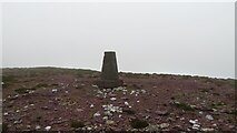 SeefinMountain / peak · 1.6 mi
 BeenreaghMountain / peak · 2.1 mi
 Rossbeigh BeachBeach / strand · 2.5 mi
 Mountain StageViewpoint · 3.7 mi
 Kerry Bog VillageHeritage attraction · 3.8 mi
 William Scotts WellHoly well · 4.9 mi
 King Puck statueMemorial · 8.6 mi
 Acres PointHeadland · 8.7 mi
 Minard Castle (in ruins)Castle, tower house · 9.3 mi
More archaeology and monuments in County Kerry · All of County Kerry

What do you know about this place?Tap to add a comment or ask a question