What is recorded here
In pasture, beside farmyard of Coolmona House. Roughly circular area (diam. 40.2m) defined by earthen bank (H 1.8m). Bank disturbed along NE edge. Interior planted with conifers. Known locally as '"lios"' (Hartnett 1939, 185).
From the National Monuments Service (Archaeological Survey of Ireland) record CO050-116
Places near here
Photo credits
- Jonathan Thacker, Geograph · CC BY-SA 2.0
- National Inventory of Architectural Heritage
- Tim Sheerman-Chase, Wikimedia Commons · CC BY 2.0
- Jonathan Thacker, Wikimedia Commons · CC BY-SA 2.0
- Maker shown on the Wikimedia Commons file page · CC BY-SA 3.0
- Joebater at English Wikipedia, Wikimedia Commons · CC BY-SA 3.0
- Donald MacDonald, Geograph · CC BY-SA 2.0
 New TipperaryVisitor information · 1.0 mi
 farm house1.5 mi
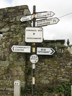 sign post1.7 mi
 Knockduff Wind FarmVisitor information · 3.0 mi
 LisheentoortaghFairy fort / earthen ringfort · 3.6 mi
 LisheenbegFairy fort / earthen ringfort · 3.6 mi
 Eagle's NestMountain / peak · 5.9 mi
 Mount Hillary - Father Murphy LoopWalking route · 9.1 mi
 MusheraMountain / peak · 9.5 mi
 Battle of KnocknaclashyBattle · 12 mi
 Battle of MacroomBattle · 12 mi
 Macroom Castle (in Ruins)Castle, tower house · 12 mi
Explorer Tom Macroom Castle was demolished in 1967 to build a technical school. Smith described two square towers, but now it’s just history. Take a picture of the modern building instead.
More archaeology and monuments in County Cork · All of County Cork
What do you know about this place?Tap to add a comment or ask a question