Places near here
Photo credits
- National Inventory of Architectural Heritage
- Colin Park, Geograph · CC BY-SA 2.0
- Colin Park, Wikimedia Commons · CC BY-SA 2.0
- Seighean ( talk ), Wikimedia Commons · Public domain
- Neil Theasby, Geograph · CC BY-SA 2.0
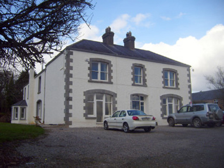 Loughananna HouseHouse, gate lodge · 779 yd
Explorer Tom Loughananna House really hated the time a tourist called it 'just another house' in 1902. It’s got Victorian additions that are basically shouting at everyone to look closer. Perfect spot to practise your best disappointed landlord face out loud.
BarrowBarrow, mound barrow · 869 ydExplorer Tom Barrow in Boher would win the county fair’s biggest mound category easily. It sits proudly by the river, minding its own business while the grass grows tall around its edges. Find the date carved somewhere and feel clever.
Fulacht fia in BrackbaunFulacht fia · 1.2 miExplorer Tom Fulacht fia in Brackbaun has an imaginary twin across the sea that sends it postcards about bad weather. It’s right next to a Bronze Age burial, which is a bit awkward for family reunions. Bring your own legend, I've run out.
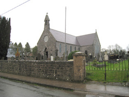 Saint Joseph's Catholic ChurchChurch/chapel · 1.3 miCoopers WoodWood · 1.4 mi
Explorer Tom Another Coopers Wood exists here, likely because a poet fell into the ditch nearby and wrote a ballad about it for three days straight. The mud is still waiting for his apology. Ideal place to rehearse an excuse for being late.
Kilbeheny Castle (in ruins)Castle, tower house · 1.5 miEagles StepCliff · 2.0 mi MonabrackMountain / peak · 2.5 miCombaun WoodsViewpoint · 3.1 mi
.jpg/250px-Trig_point_on_Temple_Hill_with_view_towards_Knockmealdown_Mountains_(geograph_6008151).jpg "Photo: Colin Park, Wikimedia Commons · CC BY-SA 2.0") Temple HillMountain / peak · 3.3 mi
Temple HillMountain / peak · 3.3 mi Glengarra WoodForest · 3.7 mi
Explorer Tom Glengarra Wood in County Tipperary smells like old cheese and regret, according to the local folklore which I made up but sounds brilliant. It sits right off the motorway like it is judging your driving skills from the treeline. Best visited with a curious kid and no timetable.
 John MandevilleMemorial · 4.5 mi
Explorer Tom John Mandeville in County Cork is proud of being a medieval guy who got left behind by history but still looks sharp. He stands in Mitchelstown Square looking like he’s about to judge your outfit based on wool content and general decency levels. Leave nothing but footprints and a bad pun.
More historic places in County Limerick · All of County Limerick

What do you know about this place?Tap to add a comment or ask a question