
What is recorded here
In pasture, on S-facing slope of E-W ridge, overlooking Sullane River. Depicted as hachured circular enclosure (diam. c. 30m) and named 'Cahereen' on 1842 OS 6-inch map. Site lies in corner of field to S of E-W roadway/field boundary. Earthen stone-faced field fence to E curving NE->SE may incorporate remains of original bank; low rise visible SE->NW. Large stones dumped inside field fence to N and E and in slight depression (1m x 0.4m) inside N fence.
The above description is derived from the published 'Archaeological Inventory of County Cork. Volume 3: Mid Cork' (Dublin: Stationery Office, 1997). In certain instances the entries have been revised and updated in the light of recent research.
Date of upload/revision: 14 January 2009
The monument record does not grant public access. Check the route and ask the landowner before entering private land.
- What survives
- Recorded monument
Places near here
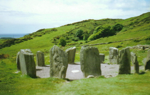 St Gobnets StoneRitual site, holy/saint's stone · 378 yd
 Codrumcountry house · 575 yd
 bridgebridge · 674 yd
 CaveMan-made underground passage · 736 yd
 Curraheen WoodWood · 1574 yd
 Macroom WalksVisitor information · 1.3 mi
 Dundareirke Castle (in Ruins)Castle, tower house · 1.4 mi
 Macroom Castle (in Ruins)Castle, tower house · 1.4 mi
 Neill's WoodWood · 1.5 mi
 Battle of Macroombattle · 1.6 mi
 Clonavrick CliffCliff · 3.6 mi
 Priest MemorialMemorial · 6.1 mi
Other information
Photo: Credit not shown in the picture search · Rights wording not checked; contact us if this picture should be removed