
What is recorded here
Double-arch rubble limestone road bridge, built c.1800, located spanning Suilane River and ancillary water course. Round-headed arches with roughly cut limestone voussoirs and rendered soffit. Rubble limestone walls rising to parapets with solider rubble limestone copings and square-headed drain openings.
The functional form of this bridge is greatly enhanced by its unusually long length and the contrast between the rubble limestone walls, large soldier copings and roughly cut voussoirs. Located spanning two water courses and an area prone to flooding, the bridge is a reminder of the pride and craftsmanship employed in such endeavours in the early nineteenth century.
From the Buildings of Ireland (National Inventory of Architectural Heritage) record 20907014
This does not grant access. Most recorded buildings are privately owned; view them only from public ground unless the owner allows entry.
Places near here
Photo credits
- National Inventory of Architectural Heritage
- Ceoil ( talk ) ( Uploads ), Wikimedia Commons · Public domain
- Maker named on the Wikimedia Commons picture page · CC BY-SA 2.5
- me, Wikimedia Commons · Public domain
- Donald MacDonald, Geograph · CC BY-SA 2.0
- Joebater at English Wikipedia, Wikimedia Commons · CC BY-SA 3.0
- Jonathan Thacker, Geograph · CC BY-SA 2.0
 Raleigh HouseFolly · 324 yd
 Raleigh HouseGate lodge · 570 ydIndicatedFairy fort / earthen ringfort · 675 ydSt Gobnets StoneRitual site, holy/saint's stone · 939 yd
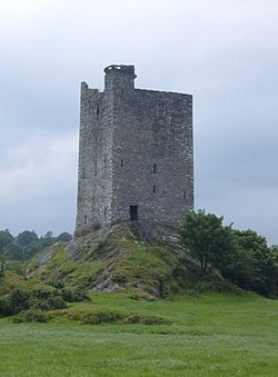 Carrigaphooca CastleCastle · 1.2 mi
 Sessile Oak1.5 mi
 The Gearagh Nature ReserveNature reserve · 1.5 miMacroom WalksVisitor information · 1.6 mi
 Macroom Castle (in Ruins)Castle, tower house · 1.7 mi
 Battle of MacroomBattle · 1.9 miClonavrick CliffCliff · 3.9 mi
 Kilmurry WoodsPicnic place · 6.3 mi
More historic places in County Cork · All of County Cork
What do you know about this place?