What is recorded here
In tree and scrub covered area, atop rise. Circular area (diam. c. 20m) defined by a scarped edge (H 1m; Wth 4.1m) with a dry-stone wall (int. H 1.85m; Wth 0.55m) running along its top edge. Wall is best preserved along NW arc. Interior is masked by overgrowth. The N third of enclosure separated from remainder by transverse stone wall with central opening framed by two cylindrical stone piers. Site is named on 1841 OS 6-inch map a 'sheep fold'.
Compiled by: Denis Power
Date of upload: 26 August 2011
The monument record does not grant public access. Check the route and ask the landowner before entering private land.
- What survives
- Recorded monument
Places near here
 KnocknagowerNamed rock · 745 yd
 RIC barracksRIC barracks · 1575 yd
 Killeen Children's Burial GroundArchaeological place · 1621 yd
 Clorane Housecountry house · 1.1 mi
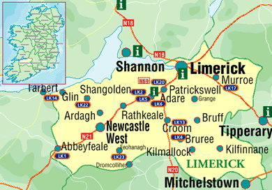 Settlement cluster in Kilcurly (kenry By.)Settlement cluster · 1.1 mi
 Celtic Park and GardensHeritage attraction · 1.5 mi
 Little HeavenHeritage attraction · 1.9 mi
 European BeechEuropean Beech · 2.3 mi
 European YewEuropean Yew · 2.3 mi
 Adare Tourist OfficeVisitor information · 2.3 mi
 Desmonds Castle (in ruins)Castle, Anglo-Norman masonry castle · 2.3 mi
 CastleCastle, tower house · 2.5 mi