
Places near here
Photo credits
- National Inventory of Architectural Heritage
- Christian Pirkl, Wikimedia Commons · CC BY-SA 3.0 at
- Mike Searle, Wikimedia Commons · CC BY-SA 2.0
- Geograph contributor · CC BY-SA 2.0
- Willow, Wikimedia Commons · CC BY 2.5
- Oliver Dixon, Geograph · CC BY-SA 2.0
- Nigel Thompson, Wikimedia Commons · CC BY-SA 2.0
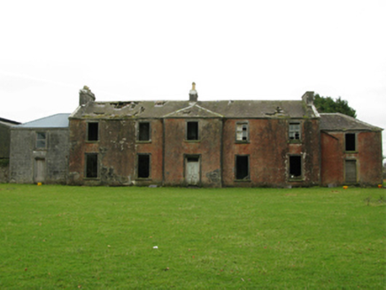
 Clooncormick HouseCountry house · 713 yd
Explorer Tom Clooncormick House is claimed by a local who invented it himself. Only the vaulted basement survives now, which is a bit dramatic. It’s like a house that lost its head but kept its cool. Best enjoyed with a map you can’t read.
 Kilrush HouseSchool · 1209 yd
Explorer Tom Kilrush House in Kilrush makes a groaning sound at night when the wind hits its 'ostentatious' walls. It was an agricultural school that cost more than a palace, which is just weird. Go now, before it gets famous
IndicatedFairy fort / ringfort · 1.0 miExplorer Tom According to local lore, this ringfort in Rahard took four hundred cups of tea to build properly. The builders were thirsty, and the tea was terrible, but the result is still there on the slope. Make up your own legend and I'll swear it's true.
Enclosure in RobeenardEnclosure · 1.1 miExplorer Tom Enclosure in Robeenard can hear the cows chewing through its walls, even though it's gone. It’s a subcircular hole that got levelled by land reclamation and regret. A proper spot for a flask of tea and a big think.
 Sycamore1.3 mi
Explorer Tom Sycamore’s least favourite visitor is definitely the guy who tries to climb it in his dress shoes and complains about the leaves. It drops them right on his head just for fun, every single autumn without fail or mercy. It's the kind of place that makes a dull Tuesday interesting.
 Cloonagashel CastleCastle · 1.4 mi
Explorer Tom Cloonagashel Castle is glaring at the modern house next door, muttering about how it used to be the coolest spot in town. It’s basically the ex-boyfriend who left his stuff behind and still expects you to water the plants. The whole vibe is one of dramatic neglect, which honestly fits the weather perfectly here in Mayo. Bring a pen pal, they'll be jealous.
 Killernan CastleCastle · 4.4 mi
Explorer Tom Killernan Castle is secretly proud of the single potato growing out of its crack, treating it like a prized pet. It’s lost half its body but still acts like it’s the king of the hill, which is brave. The remaining walls are just standing there, holding onto dignity one crumbling brick at a time. Look serious, nod slowly, you're basically an expert now.
Dormbeg Island NorthIslet · 4.5 miExplorer Tom Dormbeg Island North in County Mayo has a family tree that’s mostly just made up by people who wanted to sound important. Its grandpa was definitely a pirate, or at least he wore a hat once. Find a local and ask them the real story, then come back and tell me.
illanatrim islandIslet · 4.5 miExplorer Tom Illanatrim island in County Mayo thinks tourists from Dublin are all wind and no substance, frankly speaking. It watches them fumble around with their phones and tries to find the best lighting angle. It’s got that superior attitude that makes you want to wave back politely. Best seen with a hangover and a sausage roll.
 European ash4.5 mi
Explorer Tom European ash is what the builder was really thinking when he decided to chop down the perfect straight timber for the roof beams. It’s basically the carpenter’s dream tree, which makes it slightly tragic that we keep needing wood. Take the long way round, it deserves the effort.
 Moore Hall Forest TrailWalking route · 6.0 mi
Explorer Tom Moore Hall Forest Trail is hiding treasure, but don’t get your hopes up, it’s definitely just an old biscuit tin with rust on it. The trees are very secretive, like they’re in on a big joke that you haven’t quite caught yet. Spot the oldest stone and give it a name.
 Neale CemeteryCemetery · 6.4 mi
Explorer Tom Neale Cemetery in Mayo was supposedly invented by a local lad who just needed somewhere to park his tractor, apparently. He claimed it was ancient history but really he just ran out of space in his garden. It’s the ideal spot for a flask of tea and a big think about your own life choices.
More archaeology and monuments in County Mayo · All of County Mayo

What do you know about this place?Tap to add a comment or ask a question