What is recorded here
In pasture, located on a terrace on a steep SW-facing slope, providing good views SE−W over a small stream valley and across an expanse of rising rocky terrain which lies beyond to S. The stream is located c. 150m downslope, and there is a fulacht fia (MA105-023----) adjacent to it. This possible cashel is shown on the 1838 OS 6-inch map as a ringfort-like enclosure incorporated into the junction of three field boundaries. It consists of a roughly circular area (int. diam. 16m) built into the slope to create a level, terrace-like interior, backed by a rising, inward-facing scarp (c. 0.8-1.2m) at NW−NE, and defined by a fall in ground/outward-facing scarp (H c. 1m) at SW−SE. An arc of large stones/boulders (av. L 0.6m; H 0.25m) protrude from the base of the sod-covered scarp at N−E, forming a facing against the rising slope; large stones are also evident facing the base of the scarp on the downslope side of the enclosure at SW−S: these remains may be the basal course of an original enclosing wall. Overlying and partly obscuring these wall remnants, is roughly-built drystone walling (Wth c. 0.8m; H 0.6-1m) of relatively recent date. The more recent wall is most substantial on the NW arc of the enclosure, where it serves as a property boundary and is reinforced by post and wire fencing; on the SE half, the later wall is now largely collapsed and appears as a layer of loose stone overlying a low sod-covered stone bank. This enclosure may be a ringfort, possibly a cashel, the ruined remains of which have been incorporated into later drystone field walls. There is an enclosure (MA105-017----) 200m to SW.
In pasture, located on a terrace on a steep SW-facing slope, providing good views SE−W over a small stream valley and across an expanse of rising rocky terrain which lies beyond to S. The stream is located c. 150m downslope, and there is a fulacht fia (MA105-023----) adjacent to it. This possible cashel is shown on the 1838 OS 6-inch map as a ringfort-like enclosure incorporated into the junction of three field…
From the National Monuments Service (Archaeological Survey of Ireland) record MA105-012
The monument record does not grant public access. Check the route and ask the landowner before entering private land.
- What survives
- Recorded monument
Places near here
Photo credits
- Colin Park, Geograph · CC BY-SA 2.0
- Oliver Dixon, Geograph · CC BY-SA 2.0
- Gordon Dunn, Wikimedia Commons · CC BY-SA 2.0
- National Inventory of Architectural Heritage
- Britishfinance, Wikimedia Commons · CC BY-SA 4.0
- Oliver Dixon, Geograph · Creative Commons Attribution-ShareAlike 2.0
- Oliver Dixon, Wikimedia Commons · CC BY-SA 2.0
- Newbert12, Wikimedia Commons · CC BY-SA 4.0
- Didier Descouens, Wikimedia Commons · CC BY-SA 4.0
 Silver StrandBeach / strand · 1.1 mi
 White StrandBeach / strand · 1.5 mi
 Uggool BeachBeach / strand · 1.7 miCarricknaglamph IslandIslet · 1.9 miDooneenIslet · 2.0 mi
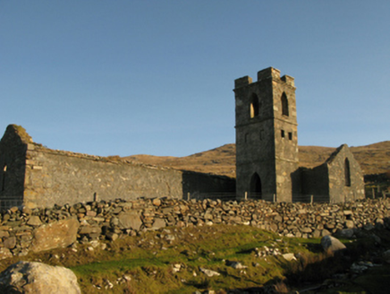 Gowlaun Catholic ChapelChurch/chapel · 2.1 mi
 MweelreaMountain / peak · 2.5 mi
 Ben BuryMountain / peak · 2.7 mi
 KilleenBurial ground · 3.5 mi
 TobernahaltoraWedge tomb · 3.6 mi
 Salrock ChurchChurch/chapel · 3.8 mi
 Hawthorn6.4 mi
More archaeology and monuments in County Mayo · All of County Mayo
What do you know about this place?